• Features
  • Books
  • Teaching
  • Digital & Film
  • Blog
  • IHS
  • Texas
  • Spotlight
  • About

The past is never dead. It's not even past

Not Even Past

Austin Historical Atlas: Mapping Austin’s Historical Markers

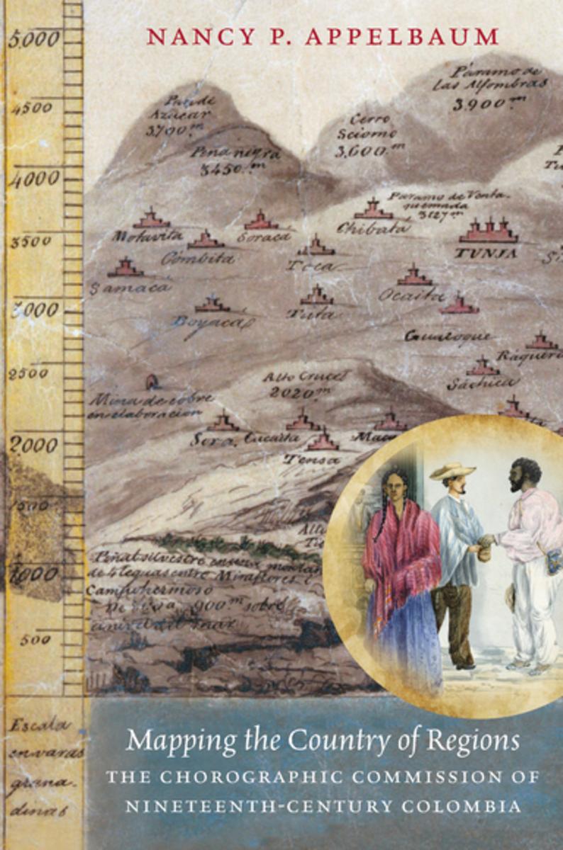
(Preview of our first page: “Austin Development During World War I”)

By Jesse Ritner

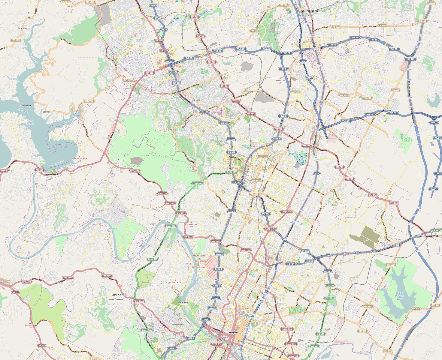
In recent years, discussions of Confederate monuments have dominated narratives of public memory in the United States. As important as this discussion is, however, Civil War monuments make up a relatively small percentage of historic markers in American cities.  Although less contentious, state and national historic markers polka dot our city-scapes, quite literally inscribing in bronze information about the city’s past on our buildings, street corners, and in our urban parks.

Often these markers seem inconspicuous.  Many list the names of long dead citizens, or remark on the importance of architectural styles far beyond the working knowledge of casual perusers.  However, these marked places do not exist in a vacuum.  Their importance relies on their relationships to other buildings and to the city at large.  Yet, that relationship is hidden.  The markers speak, when we learn their language, about important aspects of a city’s collective history, even about histories that the marker makers never intended to reveal.  Our hope, at Not Even Past, is to make these connections visible through a series of maps which we are calling a digital atlas.  In the process we will see what unexpected information might be revealed by the historical markers in our home city of Austin, Texas.

A black and white map of Austin, Texas focusing on the city's downtown area
Map of Austin in 1920 (via Wikimedia)

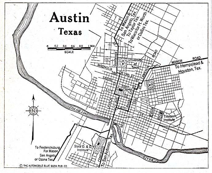
This will by no means be the first digital map of historical markers in the city of Austin.  The Texas Historical Commission offers its own map of markers, which naturally include our city.  Google Maps has a limited version, along with Stopping Points, and numerous other websites.  These maps tend to be thorough, covering relatively reliably the markers they promise, and usually offering addresses, marker titles, and occasionally the marker text (as well as limited and unreliable descriptive metadata).  In the case of the Texas Historical Commission they even offer thematic maps (i.e. Women’s History, African American History, Education, etc.).

The Austin Historical Wiki, from the UT departments of Architecture and Historic Preservation, take on important issues in the field of preservation.  How do places get preserved, and how can open sourced maps (in this case a Wiki) help to utilize historical markers more effectively? How can we discover what the community wants from their markers, rather than reflecting the desires of a wealthy, motivated, and organized few?  (To read their fascinating reflections on the project click here.)  Their goals are both admirable and important.  Nevertheless, the Austin Historical Wiki, much like these other mapping initiatives, fail (or perhaps more accurately do not attempt) at our goal of providing historical context to often bland and obtuse historical markers scattered throughout the city.

A contemporary map of the City of Austin, Texas
Contemporary Map of the city of Austin (via Wikimedia)

Historians are slowly learning from geographers, anthropologists, architects, and many others how to mine historical information that can be found in landscapes.  Geographers and architectural historians are especially good at finding and relaying information on materials, whether it be the type of granite used for the Texas Capitol Building, or the way in which the Balcones Escarpment provides Austin with reliable water during dry seasons.  Historians, in contrast, specialize in creating narratives out of historical information.  By combining these methodologies of space, data, and narrative voice with technologies such as GIS (Geographical Information Systems), historic markers can reveal a more interesting and comprehensible history of Austin that is already written onto the city.

The goal of our Digital Atlas is a map that can be viewed in layers, allowing connections to be drawn between different markers.  This may involve comparing a number of markers that occur in the same year (our first post will be about three markers related to 1917), or it may be something more familiar, in that markers are arranged and colored to allow us to see how women’s lived experience has changed over time.  We will release these layers slowly, month by month.  Some may include only a few historical markers, while others could utilize ten, twenty, or thirty.

To begin, the maps, while interactive in a limited capacity, will not necessarily help people make connections between markers on their own.  However, as layers increase, and more and more markers are entered in our Digital Atlas, we hope to create a map large enough, and with sufficiently searchable metadata, so that the map could be used as a teaching tool in classrooms, as well as a way to discover more about Austin for the curious reader.

An image of the Texas Historical Commission Plaque for the First Classes of the University of Texas Law School
Example of Texas Historical Commission Plaque (via Wikimedia)

The goal of this mapping project is not fully formed.  We want to visualize the cityscape, historically contextualize existing markers, challenge existing narratives, and identify events and people who deserve to be commemorated with historical markers, but we expect the project –and our readers—to take us in additional directions.

Building useful digital humanities and public history projects can be difficult and confusing at the start.  Despite enthusiasm on the part of departments or faculty, there is little in the way of formal training for graduate students in digital methods and tools.  In this project, we are learning by doing, and expect to adapt and change as our needs change and follow the twists and turns it takes us on.  What we can promise is transparency in our struggles and our accomplishments, honest reflection on the conflict between our goals and the reality of digital mapping, and the hope that such transparency will help others digital humanists considering such projects.

Read our first edition now: Development During World War I 

You Might Also Like:

Digital Teaching: Mapping Networks Across Avant-Garde Magazines
Mapping Indigenous Los Angelos: A Public History Project


The views and opinions expressed in this article or video are those of the individual author(s) or presenter(s) and do not necessarily reflect the policy or views of the editors at Not Even Past, the UT Department of History, the University of Texas at Austin, or the UT System Board of Regents. Not Even Past is an online public history magazine rather than a peer-reviewed academic journal. While we make efforts to ensure that factual information in articles was obtained from reliable sources, Not Even Past is not responsible for any errors or omissions.

Too Much Inclusion? Museo Casa de la Memoria, Medellín, Colombia

By Jimena Perry

In 2013, a memory museum opened in Medellín, Department of Antioquia Colombia. Its founding was part of the Victim Assistance Program created by the city’s mayoralty in 2004. Known as one of Colombia’s most violent cities, due mainly to the drug cartel of Medellín led by Pablo Escobar, this urban area suffered severe violence (bombings, targeted killings, kidnappings, bribes, threats, and massacres) from the 1980s to the mid-1990s. The communes of Medellín ‒16 divided into neighborhoods and institutional areas‒ acquired a very bad reputation during this period because most forms of violence happened there. According to official sources, such as the National Registry of Victims, 1,383.988 of 8,421,627 registered victims nationwide, are from the Department of Antioquia.

The house-museum (casa museo) is conceived as part of the symbolic reparation of victims the state must pursue, as a space in which they can grieve, come together to tell their stories, and heal. The museum has 378 testimonies that can be heard, viewed, and read. The building in which it is housed has three stories. The first one is a temporary exhibition space, the second is where the permanent display is, and the third is a documentation center. Located downtown, the museum is at the Bicentenario Park and behind a traditional theatre.

Museo Casa de la Memoria, Medellín (Jimena Perry, 2017).

The permanent exhibition of the museum is divided into 16 topics. The first one, named Absences, opens the hall with a mirror wall in which people can read fragments of testimonies related to the sadness of losing loved ones, homes, lands, and domestic animals. The second one, Nostalgic Landscapes, is an audiovisual projected on a wall in which one can observe Antioquia’s rural sceneries affected by the armed conflict. It is meant to convey the pain of forced displacement. The third one, called simply Medellín, is a narrative of the city’s history since 1541. It includes indigenous peoples, afrodescendants, and peasants, trying to be as inclusive as possible. The fourth, Sensitive Territories, is composed by three interactive cartographies which show the numbers of the department´s municipalities, facts of victimization that are remembered collectively, and memory sites in Medellín. These cartographies are intended to highlight how the people from Antioquia resisted the conflict, to denounce atrocities, and to call the viewers’ attention to social mobility.

Interactive Cartographies. People can touch the screens and navigate through information related to violence, victims, and memory (Jimena Perry, 2017).

The fifth space is called Medellín in Movement. It is also a video in which spectators can see the city in action. It shows streets, people, activities, traffic, day, night, and the different ways of inhabiting the urban center. The sixth one, Children’s Words, is a touching panel in which kids define words such as love, violence, fear, dead, displacement, and murder. This is one example: “Murder: To take away the best of a person.” This sentence was written by a nine-year-old boy. The seventh, is an interactive chronology, from 1946 to 2013, in which the history of Colombian violence is told. This piece sticks out due to its grand size and the information it contains. A person can click on its links to find out specific data about certain events, such as the creation of the Fuerzas Armadas Revolucionarias de Colombia, FARC-EP (Armed Revolutionary Forces of Colombia-People’s Army), peace processes, and institutional efforts to end the country’s armed conflict.   

Interactive Chronology (Jimena Perry, 2017).

Space number eight is perhaps one of the most impressive of the displays. It is called Multiple Faces of Violence. This is a sample of approximately 50 pictures taken by four known photographers. The images are displayed in triptychs which the observer can turn and alternate. They are shocking and capture many violent moments that deserve reflection. Besides the pictures there is an interactive screen where the photographers tell their experiences taking the images. The following pictures are the work of Natalia Botero, Jesús Abad Colorado, Albeiro Lopera and Steven Ferry. I chose only a few of them. The images reproduced here were taken by Jimena Perry.

The ninth topic of the permanent exhibition is named Words. Like with the children’s definitions, here children and adults play with the meanings of fear, solidarity, resiliency, memory and difference. The tenth space, Whispers, as shocking or more as the former, is composed by 13 wooden boxes attached to a wall. If someone places his or her ear to a box, a testimony of violence can be heard. The narrative of each box is different and some of them are very hard to listen to.

Wooden Boxes (Jimena Perry, 2017).

The eleventh space is a composition of 16 cases with artistic pieces in which the armed conflict is represented. They are in the middle of the permanent hall and include topics such as violence against the earth and indigenous communities. The twelfth one, Present Histories, is made of three person-size panels in which recent victims — survivors of violence, politicians, activists of human rights, and priests — give their views and experiences of war. Twenty-four different voices can be heard here. Space thirteen is a recompilation of recent songs with social meaning. Here people can stop to listen to the music, which is mainly hip-hop and rap. The fourteenth one, Art’s Point of View, is also an interactive panel that presents artistic works in which violence is depicted. The fifteenth one, Memory Enclosure, is a wall in which the viewer observes images that come and go over a black screen. The pictures allude to birthdays, baptisms, and everyday life activities and chores to remind the viewer how life was interrupted violently. The last part of the permanent exhibition is a long hall in which there are fragments of speeches of human rights activists, writers, and other people who had fought for peace in Colombia.

“To close old wounds. And that from death new life arises.” (Jimena Perry, 2017)

Medellín’s House-Memory Museum is a place intended to give voice to Medellín’s victims of violence and provide them a site to grieve, reunite, remember, and develop strategies to avoid future violence. The institution’s first director defined this mission clearly enough, however the second and current one is implementing some changes. She said publicly that the museum should not only be for victims and perpetrators but for every citizen. This statement caused uneasiness in the city’s inhabitants because the space is supposed to represent symbolically the people directly affected by violence. So, here big questions come up: How much inclusion is desirable? Which is the audience of the institution?

Another issue worth mentioning is the absence of drug trafficking victims at the museum. Even though Pablo Escobar was born in Rionegro, his business was all run in the capital of Antioquia. Escobar and his organization, the Medellín Cartel, committed 623 attacks that left hundreds of dead civilians and thousands wounded. The Cartel also was responsible for the murder of 550 policemen, 100 bombs in Bogotá and Medellín in malls, official institutions, airplanes, and newspapers. Approximately 15,000 people died due to the actions of the Medellín Cartel between 1989 and 1993. Among the deceased were presidential candidates, journalists and politicians. Kidnappings of politicians and journalists were very common as well. It is surprising that the museum does not mention these victims. This is a part of Colombian history that remains absent from most institutions, drug lords are not part of museum narratives leaving big silences that need to be filled. Perhaps telling this part of history should also be part of the healing process.


Also by Jimena Perry on Not Even Past:

Time to Remember: Violence in Museums and Memory in Colombia, 2000-2014
My Cocaine Museum, by Michael Taussig (2004)

You may also like:

Magical Realism on Drugs: Colombian History in Netflix’s Narcos

Mapping the Country of Regions: The Chorographic Commission of Nineteenth-Century Colombia, by Nancy P. Appelbaum (2016)

By Madeleine Olson

What occurs when elite driven narratives about national identity dramatically different differ from the realities people experienced? During the nineteenth century throughout Latin America, when national boundaries were just beginning to become coherent, the upper echelons of society constructed tales about their nations that often vastly differed from lived experiences.

Between 1850 and 1859, the Chorographic Commission traveled the territory of present day Colombia in an attempt to map the land and the people who lived there, using chorography, or detailed representations of a particular region. Sponsored by the government of New Granada (an older name for Colombia), the commission produced a wealth of maps, texts, illustrations, as well as travel journals and diaries, in order to construct the image of a unified nation. Implicit in the commission’s initial mandate was the assumption that it would justify the existing administrative order by making that order appear natural.

The visual culture it produced, however, depicted a nation that was far from cohesive, with regional individuality and diversity.  Instead of portraying a unified nation, the commission presented the country as fragmented into different, and often opposing regions, inhabited by racially and culturally distinct races, that reinforced assumptions of Andean and white mestizo superiority. In this new book, Nancy Appelbaum expands our understanding of this central paradox, demonstrating that the commission’s materials reveal some of the ways that Colombian elites grappled with the challenges posed by varied topographies and diverse inhabitants.

The leaders of the Chorographic Commission included both foreign members and others who were born and bred in New Granada. Two of the key figures on the commission, whose writings play an important role throughout the book, were Agustín Codazzi and Manuel Ancízar. Born in Italy’s papal states and a Napoleonic war veteran, Codazzi was in fact first contracted to map the Venezuelan provinces, which had seceded from Gran Colombia, in 1830. The secession precipitated Gran Colombia’s dissolution into Venezuela, Ecuador, and New Granada. Manuel Ancízar, a Colombian lawyer, writer, and journalist, joined Codazzi on the Commission in 1850.

Gran Colombia and modern countries (via Wikimedia Commons).

Using personal correspondence between Codazzi and Ancízar, Appelbaum argues that although the creation of the commission reflected nationalist aspirations of the government, it was fundamentally shaped through its leaders’ own exposure to foreign culture. The geographic writings of Prussian Alexander von Humboldt, as well as Italian Adriano Balbi, strongly influenced Codazzi’s and Ancízar’s initial overviews, as they “draped themselves in the ‘mantle of Humboldtianism’ to emphasize their own scientific legitimacy.” Inspired by Humboldt, Codazzi divided the terrain of New Granada according to the differing altitudes, winds, and vegetables that he encountered. The ideological influence of Humboldt, together with Balbi’s schematic list methodology, helped the Commission create a novel and distinct approach to chorography that was more affordable than the fashionable trigonometric survey.

The detailed accounts produced by Codazzi and Ancízar on the commission’s initial expeditions to the highland region of Antioquia and the Pacific lowland, comprised not only field reports, but also included detailed watercolors created by the commission’s first illustrators in order to depict the populations they encountered.  Through comparing the perceptions noted in the field reports with the pictorial representations, the tension comes out between the inclination to show these regions as homogenous when the commission clearly experienced great heterogeneity of the people and customs.

William Price, Typical Inhabitants of the Province of Medellín (via World Digital Library).

This visual culture reflected a literary and artistic current in nineteenth-century Latin America called costumbrismo, or using descriptive prose and dialogue to verbally paint a local scene,  emphasizing the customs and particularities of that locale. Within these works, tipos “types” that organized the population into component parts defined by race, occupation, and place, were created to provide both a visual and discursive way to manage the heterogeneity that the commission encountered. In William Price’s Tipos de Medellin, the commission’s artists displayed idealized images of people one would encounter when visiting these places. These images of the racial types that the commission produced updated the eighteenth-century genre of casta paintings for the republican era.

As the commission moved into the tropical lowlands and the eastern plains, Appelbaum further elaborates how the illustrations were largely aimed at an external audience in order to attract immigrants and economic investment to the region. The commission’s efforts were not meant to simply represent the landscape, they were also to transform it in the service of economic advancement. Codazzi believed that these areas, rich in agriculture and livestock, could support many more people than their sparse, midcentury population.  Elites defined the tropics, for instance, as being filled with disease, poverty, and backwardness, making it a desirable region for colonization and improved methods of production. The commission took on an ethnographic dimension, as studying the population became an integral part in determining the economic capabilities of the land. Reports, maps, and paintings that Codazzi, Ancízar, and others, produced provided abundant information aimed to facilitate the conquest of the regions they mapped and studied.

Manuel María Paz, Provincia del Chocó: Aspecto esterior de las casas de Nóvita (via World Digital Library).

Applebaum goes on to discuss the methods that mid-nineteenth-century intellectuals living in the highlands around Bogotá employed to rationalize their claim over the local populations. By emphasizing the glorious origins and civilization of the Andean region around Bogotá, at the expense of lower “savage” climates, intellectuals reinforced Bogotá’s claim over this topographically disparate territory. Codazzi projected national history into the ancient past by weaving geology, archeology, and history together and referencing the past as “history” rather than prehistory. They placed themselves, not the local indigenous populations, who ultimately were the Commission’s guides, at the top of the intellectual scale to read the cataclysmic past.

Carmelo Fernández, Piedra grabada de Gámesa. Provincia de Tundama (via World Digital Library).

After Codazzi died in 1859, elites left behind tried to make sense of his project and battled each other over meanings and representations of the nation. Although members of the commission had high hopes for the mass reproduction and circulation of the materials they produced, that did not occur.  Chorography and the work of the Chorographic Commission died with Codazzi, supplanted later in the nineteenth century by newer forms of mapping which are still common today, such as topography.

Although the work that the Chorographic Commission created between 1850 and 1859 was not as widely received as hoped, the spatialized and racialized regional hierarchy inherent in its visual materials would be reproduced and refined within Colombian scholarly and popular discourse. By no means the originator of this fragmented discourse, the Commission’s cartographic project formed the basis for most maps of Colombia into the early twentieth century.

Gracefully written, integrating over thirty images and maps, Mapping the Country of Regions ­­­offers a fascinating window into both the visual culture produced during the nineteenth century in Colombia, and the ways that territories, boundaries, and state-lines are constructed. Appelbaum’s contextualization of her source base that she makes explicit within her analysis heightens her claims about the use of geographic, ethnographic, and visual methods to secure territory.  This theme of racialization of geographic hierarchy is not solely limited to Colombia, as ideas about how race and region have historically informed each other throughout Latin America. The blending of analysis with visual representation enables this book to be of use for those interested in not only Latin American nation-state building, but this  methodology of combining visual and textual analysis would be of value for anyone incorporating visual culture into their own work.

Nancy P. Appelbaum, Mapping the Country of Regions: The Chorographic Commission of Nineteenth-Century Colombia (Chapel Hill: The University of North Carolina Press, 2016).


Also by Madeleine Olson on Not Even Past:
A Texas Historian’s Perspective on Mexican State Anticlericalism.

You may also like:
Antonio de Ulloa’s Relación Histórica del Viage a la America Meridional, by Haley Schroer.
Casta Paintings, by Susan Deans-Smith.


Recent Posts

  • IHS Workshop: “Whose Decolonization? The Collection of Andean Ancestors and the Silences of American History” by Christopher Heaney, Pennsylvania State University
  • Converting “Latinos” during Salem’s Witch Trials: A Review of Cotton Mather’s Spanish Lessons: A Story of Language, Race, and Belonging in the Early Americas (2022) by Kirsten Silva Gruesz
  • Breaking ChatGPT: Good Teaching Still Beats the Best AI
  • Remembering Rio Speedway
  • Fear Not the Bot: ChatGPT as Just One More Screwdriver in the Tool Kit
NOT EVEN PAST is produced by

The Department of History

The University of Texas at Austin

We are supported by the College of Liberal Arts
And our Readers

Donate
Contact

All content © 2010-present NOT EVEN PAST and the authors, unless otherwise noted

Sign up to receive our MONTHLY NEWSLETTER

  • Features
  • Books
  • Teaching
  • Digital & Film
  • Blog
  • IHS
  • Texas
  • Spotlight
  • About