• Features
  • Reviews
  • Teaching
  • Watch & Listen
  • About

The past is never dead. It's not even past

Not Even Past

Digital Tools for the Classroom: A Guide to Using Hypothes.is in History Courses

Banner for Digital Tools for the Classroom: A Guide to Using Hypothes.is in History Courses

Historical research often feels like a solitary process. Students pore over readings, visit archives, and write papers alone. There are limited opportunities to collaborate on group projects or engage in peer review. New technologies can shift this dynamic. Digital tools can help transform the traditionally lonely aspects of historical study into a more collaborative process. Social annotation platforms like Hypothes.is create new possibilities for engagement with historical texts that allow students to build community and develop critical reading skills. This guide to using Hypothes.is explores how such platforms can enhance the learning experience in humanities courses.

Getting Started with Hypothes.is

Hypothes.is allows users to highlight, comment, and annotate documents. This is a relatively straightforward platform that integrates with most learning management systems and works with PDFs, web pages, and other digital media. To get started, instructors and students must register for a free account on Hypothes.is. Registration allows users to annotate and respond to others within a shared document. Professors can invite collaborators, create student groups, upload readings, and assign projects with specific annotation tasks.

Screenshot of hypothes.is to set free account.

Hypothes.is provides several resources for getting started on their website. Some general recommendations are to establish clear expectations about the quality of annotations. While instructors may assign a certain number of comments, they should also encourage students to pose analytical questions, make connections across texts, or identify historiographical arguments. Additionally, professors should consider requiring students to respond to at least one annotation by a classmate rather than only generating individual comments. These practices help avoid superficial engagement and promote more meaningful dialogue.

Timing is also particularly important when incorporating social annotation assignments into courses. Having students finish annotations 24 to 48 hours before class gives everyone a chance to review their peers’ comments. It also allows instructors to identify themes for discussion based on student interests and questions. This process creates a bridge between individual preparation and classroom dialogue.

Reimagining Historical Reading as a Collective Enterprise

Hypothes.is’ collaborative approach is especially valuable for history courses that rely on careful reading and analysis of texts, ranging from primary sources to academic monographs. Traditionally, students read these materials alone and develop their own interpretations. Their only opportunity for additional perspectives comes from class discussion, which often has uneven participation due to class sizes and time constraints. Social annotation platforms change this dynamic by creating a digital space where multiple readers can engage with a text simultaneously.

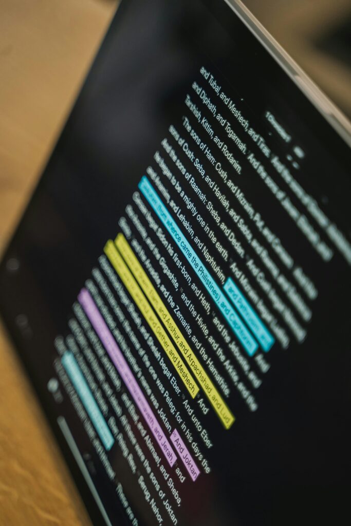
Image of annotated text on a screen.
Text on Tablet Screen. Source: Tima Miroshnichenko

When students collaborate on annotations, they engage in asynchronous dialogue that enriches the reading experience. Hypothes.is allows students to see how their peers approach historical analysis—what questions they ask, what connections they make, and what aspects of the text they find significant. This visibility of analytical processes helps students develop their own historical thinking skills.

Moreover, collaborative annotation transforms the margins of texts into spaces for dialogue where students can pose questions about difficult passages and gain insights from classmates or instructors. This process fosters a more dynamic reading experience, blending individual analysis with group discussion. Shy students who might hesitate to speak in class often feel more comfortable sharing their thoughts through written annotations.

Likewise, the collective approach helps students recognize that confusion is a natural part of engaging with new material. The questions and dialogue that emerge show students that their classmates are also wrestling with difficult passages or challenging concepts. This shared vulnerability frequently leads to more authentic engagement with both the material and their peers.

Screenshot of hypothes.is featuring a globe and their logo

Limitations and Challenges

Social annotation platforms offer compelling benefits for history courses, but they are not without limitations. Timing and participation patterns present challenges. For example, students who complete their assigned readings at the last minute might submit annotations close to, or after, deadlines. This limits the opportunity for meaningful dialogue with their classmates, who will have fewer comments and questions to comment on while reading. Last-minute participation can prevent organic and ongoing conversation and lead to a set of disconnected observations. Moreover, early participants may feel discouraged if their thoughtful annotations receive no response from classmates.

Technical barriers can also impede effective implementation. Some students may struggle with accessing or navigating the platform, particularly if they are using older devices or have limited internet access. These accessibility issues could create or exacerbate inequitable learning experiences. Some historical documents, particularly those with complex formatting or poor digitization, may not display properly on the annotation platform. This technical issue may limit the professor’s ability to assign primary source materials.

Despite these challenges, platforms like Hypothes.is offer exciting possibilities for shaping how students engage with historical texts. By making reading a collaborative activity, these tools can deepen analysis, build community, and better prepare students for meaningful classroom discussions. However, educators should consider potential challenges when incorporating these platforms into their course. Regular feedback from students about their annotation experience can help instructors adjust their approach based on specific course objectives and student needs. With careful implementation, social annotation platforms can be a highly valuable addition to the historian’s pedagogical toolkit.

Gabrielle Esparza is a Ph.D. candidate in Latin American history, with a focus on twentieth-century Argentina. Her dissertation examines the evolution of President Raúl Alfonsín’s human rights policies from his candidacy to his presidency in post-dictatorship Argentina. At the University of Texas at Austin, Gabrielle has served as a graduate research assistant at the Texas State Historical Association and as co-coordinator of the Symposium on Gender, History, and Sexuality in 2020-2021. Gabrielle was also Associate Editor and Communications Director of Not Even Past from 2021-2022. Currently, Gabrielle works as a graduate research assistant in the Institute for Historical Studies and as an Editorial Assistant for The Americas: A Quarterly Review of Latin American History.

The views and opinions expressed in this article or video are those of the individual author(s) or presenter(s) and do not necessarily reflect the policy or views of the editors at Not Even Past, the UT Department of History, the University of Texas at Austin, or the UT System Board of Regents. Not Even Past is an online public history magazine rather than a peer-reviewed academic journal. While we make efforts to ensure that factual information in articles was obtained from reliable sources, Not Even Past is not responsible for any errors or omissions.
Saving History: Cultural Heritage, Preservation and Public Service

In 2018, I was on a research expedition in Caracas, Venezuela. My days were filled with scheduling visits to libraries and repositories to start research for my dissertation on foreign oil companies and their activities in twentieth-century Venezuela. One sunny afternoon, an old mentor from my undergraduate years invited me to his private club. We were joined by another historian who shared an interest in my Ph.D. research at the University of Texas at Austin.

Sitting beside the swimming pool, our conversation revolved around our respective research projects. It quickly became evident that accessing primary sources in Venezuela posed a significant challenge. To start, there was minimal online information available. Most public and private libraries lacked online repositories accessible to researchers. Furthermore, many of the country’s archives and libraries were in dire condition. Underfunded and understaffed, they needed help to keep their doors open. To make matters worse, they had to limit their weekly operating hours.

Aware of these hurdles, my colleague, Guillermo Guzmán, and I began contemplating ways to preserve the country’s cultural heritage. Over the next few months, we explored various avenues to address this problem. Our attempts to secure funding for digitizing historical collections from the National Assembly (the equivalent of the U.S. Congress) proved futile. It soon became apparent that, as individual researchers, obtaining financial resources for digitization projects was an uphill battle. The logical step was establishing an organization dedicated to preserving the country’s history.

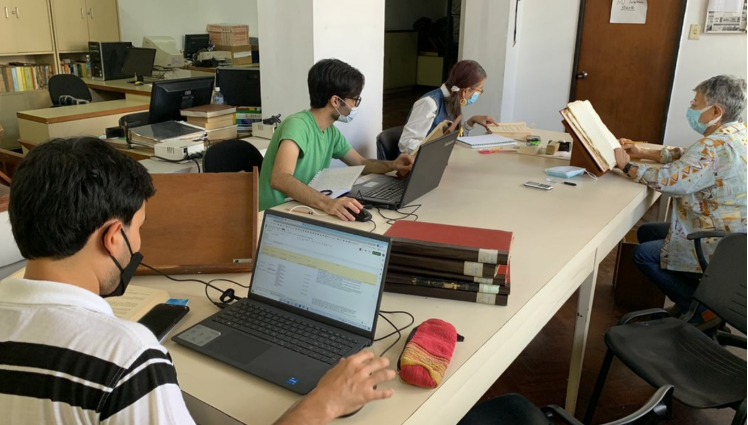
Marcus Golding (to the right) and Guillermo Guzmán Mirabal (co-founders of Red Historia Venezuela) at the Research Department. Academia Nacional de la Historia.
Marcus Golding (to the right) and Guillermo Guzmán Mirabal (co-founders of Red Historia Venezuela) at the Research Department. Academia Nacional de la Historia. Photograph by the author.

Incorporated in Venezuela and founded in 2021, the Fundación Red de Historia Digital Venezolana, known in English as The Venezuela History Network, simplified the application process for international grants. As this initiative unfolded, we were contacted by the National Academy of History of Venezuela, a prestigious public institution with a rich tradition of physically preserving archival materials and generating new knowledge about Venezuela’s and Latin America’s past. One of its colonial collections, the Civil-Slaves Section, faced infrastructural issues. This repository’s contents document the trials, civil cases, and petitions for freedom involving enslaved Afro-Venezuelans. Severe rains at the end of 2020 had compromised the ceiling where the collection was stored, prompting the archivists to relocate it. This institution sought our assistance in digitally preserving the collection. Through an inter-institutional agreement between the Venezuela History Network and the National Academy of History, we devised a plan to initiate the digitization of the Civil-Slaves Section. We also started looking for international grants. Our best supporter emerged in the form of the Gerda Henkel Stiftung from Germany. Thanks to the generous support of the Gerda Henkel Stiftung in 2022, the Venezuela History Network embarked on a digitization and preservation project for the Civil-Slaves Section.

Red Historia Venezuela logo
Red Historia Venezuela logo. Source: Red Historia website

After eight months of intensive labor, the project concluded. The Venezuela History Network successfully digitized 381 bound volumes and 23 boxes containing unbound documents, totaling 123,800 pages or 61,900 digital captures. This collaborative effort also facilitated infrastructural improvements to the room housing the collection, the acquisition of essential equipment such as scanners and laptops, and the creation of our current website and open-access digital library. Notably, this project allowed our team of paleographers, archivists, and researchers to train in best practices for digitizing historical materials. It’s worth mentioning that neither the Venezuela History Network nor the National Academy of History had any prior experience with digitization and metadata creation. The Conservation Center for Art & Historic Artifacts provided the necessary training to accomplish this vital task.

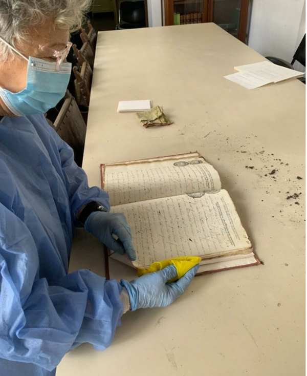
Paleographer Zully Chacón removing dust and debris from a colonial volume
Paleographer Zully Chacón removing dust and debris from a colonial volume. Photograph by the author.

The successful execution of the digitization project on the history of enslaved Afro-Venezuelans enabled us to reach new audiences. We promoted this new collection through online channels, social media, and public events, such as the one hosted at the Institute for Historical Studies at the University of Texas in Austin in October 2022. This first effort brought forth new challenges as well. In 2023, we were given numerous opportunities to digitize additional historical archives and diversify our collections catalog. Currently, the Venezuela History Network is engaged in at least six ongoing or soon-to-commence projects in collaboration with prestigious organizations like the Modern Endangered Archives Program at the University of California Los Angeles and the Center for Research Libraries through the Latin American Material Project (LAMP) initiative. We plan to create collections covering the history of Cocoa, the private papers of former Venezuelan presidents, two cultural and political magazines from the twentieth century, and an archive documenting the HIV and LGBTQIA+ movements in the upcoming year. These initiatives are collaborative efforts involving public institutions, private individuals, and non-profit organizations. We’ve also presented our mission at universities, local radio and YouTube channels, and even tech events in Las Vegas, of all places! Although we remain a relatively small organization, the Venezuela History Network is eager to establish new partnerships and connect with individuals interested in collaborating with us.

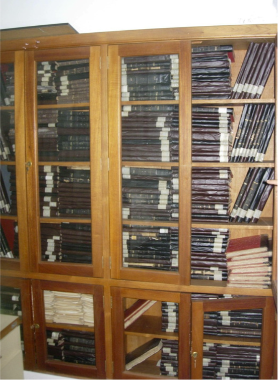
Colonial records are temporally relocated after intense rains undermined the ceiling
Colonial records are temporally relocated after intense rains undermined the ceiling. Photograph by the author.

In my capacity as a historian, these achievements have illuminated a profound truth: that we can do more as activists, historians and social entrepreneurs. History should serve a purpose beyond academia. In my case, I am contributing to the digital preservation of my country’s history. What’s more, through our open-access library, the Venezuela History Network is bringing history directly to the people, facilitating their reconnection with their own past.

A team of paleographers from Red Historia Venezuela and the National Academy of History createing metadata for each colonial document
A team of paleographers from Red Historia Venezuela and the National Academy of History creating metadata for each colonial document. Photograph by the author.

The digital copies retained by our partners after each project’s completion ensure that, even if circumstances change in the future, the historical collections we are digitizing will endure. To further this cause, we also extend our assistance to local partners in getting their collections online. Admittedly, this isn’t a definitive solution. Our current scope of work remains confined primarily to Caracas and its surrounding areas. There exist numerous archives and libraries in other provinces that find themselves helpless. The country urgently requires substantial investments in the infrastructure and human capital of libraries and archives to genuinely safeguard our cultural heritage. In the meantime, the Venezuela History Network is endeavoring to fill this void, leveraging every bit of experience we gain to assist in this monumental undertaking. Through local and international alliances, we hope that new organizations and groups will join us in this titanic effort, hence the word network in the name of our institution.

The need to provide reliable and easy access to historical materials is crucial. Communities and individuals alike want to discover and access their own histories. If you’re a historian or another type of scholar with a drive or calling to contribute to the world of history, follow your instincts, get organized, and embark on collaborative work with your community. Your impact, however small, will leave an enduring legacy for generations to come.


Marcus Golding is a Ph.D. candidate in the History department. He holds a B.A. in Liberal Arts from Universidad Metropolitana in Caracas, Venezuela, and a M.A. in Latin American Studies from Georgetown University. Born and raised in Venezuela, Golding’s research interests as a Ph.D. student include business and labor histories in Latin America during the Cold War and the cultural, social, and economic influences of US petroleum businesses in the region and in Venezuela specifically. Marcus is also the co-founder of the Venezuela History Network, an organization focused on the digitization of archives at risk in Venezuela and the promotion of the digital humanities in general. 

The views and opinions expressed in this article or video are those of the individual author(s) or presenter(s) and do not necessarily reflect the policy or views of the editors at Not Even Past, the UT Department of History, the University of Texas at Austin, or the UT System Board of Regents. Not Even Past is an online public history magazine rather than a peer-reviewed academic journal. While we make efforts to ensure that factual information in articles was obtained from reliable sources, Not Even Past is not responsible for any errors or omissions.
Austin Historical Atlas: Mapping Austin’s Historical Markers

(Preview of our first page: “Austin Development During World War I”)

By Jesse Ritner

In recent years, discussions of Confederate monuments have dominated narratives of public memory in the United States. As important as this discussion is, however, Civil War monuments make up a relatively small percentage of historic markers in American cities.  Although less contentious, state and national historic markers polka dot our city-scapes, quite literally inscribing in bronze information about the city’s past on our buildings, street corners, and in our urban parks.

Often these markers seem inconspicuous.  Many list the names of long dead citizens, or remark on the importance of architectural styles far beyond the working knowledge of casual perusers.  However, these marked places do not exist in a vacuum.  Their importance relies on their relationships to other buildings and to the city at large.  Yet, that relationship is hidden.  The markers speak, when we learn their language, about important aspects of a city’s collective history, even about histories that the marker makers never intended to reveal.  Our hope, at Not Even Past, is to make these connections visible through a series of maps which we are calling a digital atlas.  In the process we will see what unexpected information might be revealed by the historical markers in our home city of Austin, Texas.

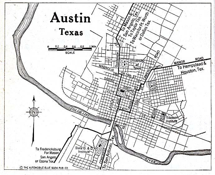
A black and white map of Austin, Texas focusing on the city's downtown area
Map of Austin in 1920 (via Wikimedia)

This will by no means be the first digital map of historical markers in the city of Austin.  The Texas Historical Commission offers its own map of markers, which naturally include our city.  Google Maps has a limited version, along with Stopping Points, and numerous other websites.  These maps tend to be thorough, covering relatively reliably the markers they promise, and usually offering addresses, marker titles, and occasionally the marker text (as well as limited and unreliable descriptive metadata).  In the case of the Texas Historical Commission they even offer thematic maps (i.e. Women’s History, African American History, Education, etc.).

The Austin Historical Wiki, from the UT departments of Architecture and Historic Preservation, take on important issues in the field of preservation.  How do places get preserved, and how can open sourced maps (in this case a Wiki) help to utilize historical markers more effectively? How can we discover what the community wants from their markers, rather than reflecting the desires of a wealthy, motivated, and organized few?  (To read their fascinating reflections on the project click here.)  Their goals are both admirable and important.  Nevertheless, the Austin Historical Wiki, much like these other mapping initiatives, fail (or perhaps more accurately do not attempt) at our goal of providing historical context to often bland and obtuse historical markers scattered throughout the city.

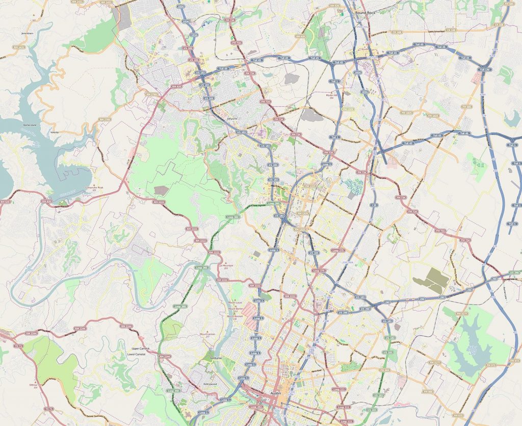
A contemporary map of the City of Austin, Texas
Contemporary Map of the city of Austin (via Wikimedia)

Historians are slowly learning from geographers, anthropologists, architects, and many others how to mine historical information that can be found in landscapes.  Geographers and architectural historians are especially good at finding and relaying information on materials, whether it be the type of granite used for the Texas Capitol Building, or the way in which the Balcones Escarpment provides Austin with reliable water during dry seasons.  Historians, in contrast, specialize in creating narratives out of historical information.  By combining these methodologies of space, data, and narrative voice with technologies such as GIS (Geographical Information Systems), historic markers can reveal a more interesting and comprehensible history of Austin that is already written onto the city.

The goal of our Digital Atlas is a map that can be viewed in layers, allowing connections to be drawn between different markers.  This may involve comparing a number of markers that occur in the same year (our first post will be about three markers related to 1917), or it may be something more familiar, in that markers are arranged and colored to allow us to see how women’s lived experience has changed over time.  We will release these layers slowly, month by month.  Some may include only a few historical markers, while others could utilize ten, twenty, or thirty.

To begin, the maps, while interactive in a limited capacity, will not necessarily help people make connections between markers on their own.  However, as layers increase, and more and more markers are entered in our Digital Atlas, we hope to create a map large enough, and with sufficiently searchable metadata, so that the map could be used as a teaching tool in classrooms, as well as a way to discover more about Austin for the curious reader.

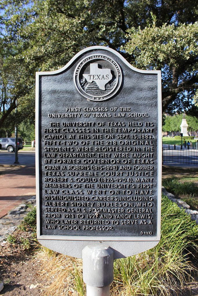
An image of the Texas Historical Commission Plaque for the First Classes of the University of Texas Law School
Example of Texas Historical Commission Plaque (via Wikimedia)

The goal of this mapping project is not fully formed.  We want to visualize the cityscape, historically contextualize existing markers, challenge existing narratives, and identify events and people who deserve to be commemorated with historical markers, but we expect the project –and our readers—to take us in additional directions.

Building useful digital humanities and public history projects can be difficult and confusing at the start.  Despite enthusiasm on the part of departments or faculty, there is little in the way of formal training for graduate students in digital methods and tools.  In this project, we are learning by doing, and expect to adapt and change as our needs change and follow the twists and turns it takes us on.  What we can promise is transparency in our struggles and our accomplishments, honest reflection on the conflict between our goals and the reality of digital mapping, and the hope that such transparency will help others digital humanists considering such projects.

Read our first edition now: Development During World War I 

You Might Also Like:

Digital Teaching: Mapping Networks Across Avant-Garde Magazines
Mapping Indigenous Los Angelos: A Public History Project


The views and opinions expressed in this article or video are those of the individual author(s) or presenter(s) and do not necessarily reflect the policy or views of the editors at Not Even Past, the UT Department of History, the University of Texas at Austin, or the UT System Board of Regents. Not Even Past is an online public history magazine rather than a peer-reviewed academic journal. While we make efforts to ensure that factual information in articles was obtained from reliable sources, Not Even Past is not responsible for any errors or omissions.
Austin Historical Atlas: Development During World War I

(This is the first of a series that will explore creative ways to think about historic markers in Austin.)

By Jesse Ritner

1917 marked a turning point in the history of Austin’s development.  A large donation and the dismembering of a family estate spread the city west and north, resulting in dramatic increases in public spaces, urban housing, and wealth for the Austin public schools.  Yet, Austin’s growth came at the expense of one specific neighborhood.  The story is already written onto the city, if we know where to look.

The Andrew Jackson Zilker marker (placed in 2002), the Clarksville Historic District marker (placed in 1973), and the Crusemann-Marsh-Bell House (placed in 2009) seem to be about distinctly different historical events.  Zilker’s, located in front of the Barton Springs Pool House, informs us about the life of Austin’s “most worthy citizen” in basic outline, emphasizing his rags to riches story, and his generous philanthropy.  The Clarksville marker, on the other hand, recounts a story of survival.  It details the resilience of the black community of Clarkville, founded by freed slaves in 1871, who refused to move for over a century, despite repeated pressure from the city of Austin.  Last, the Crusemann-Marsh-Bell House marker comments on the architecture of this 1917 home, built by the “granddaughter of Texas Governor E.M. Pease.”  By themselves, the three markers recount one story of wealth, one of poverty, and one involving the American Dream. Collectively, they tell a dramatic geographic history of urban expansion into west Austin in 1917.

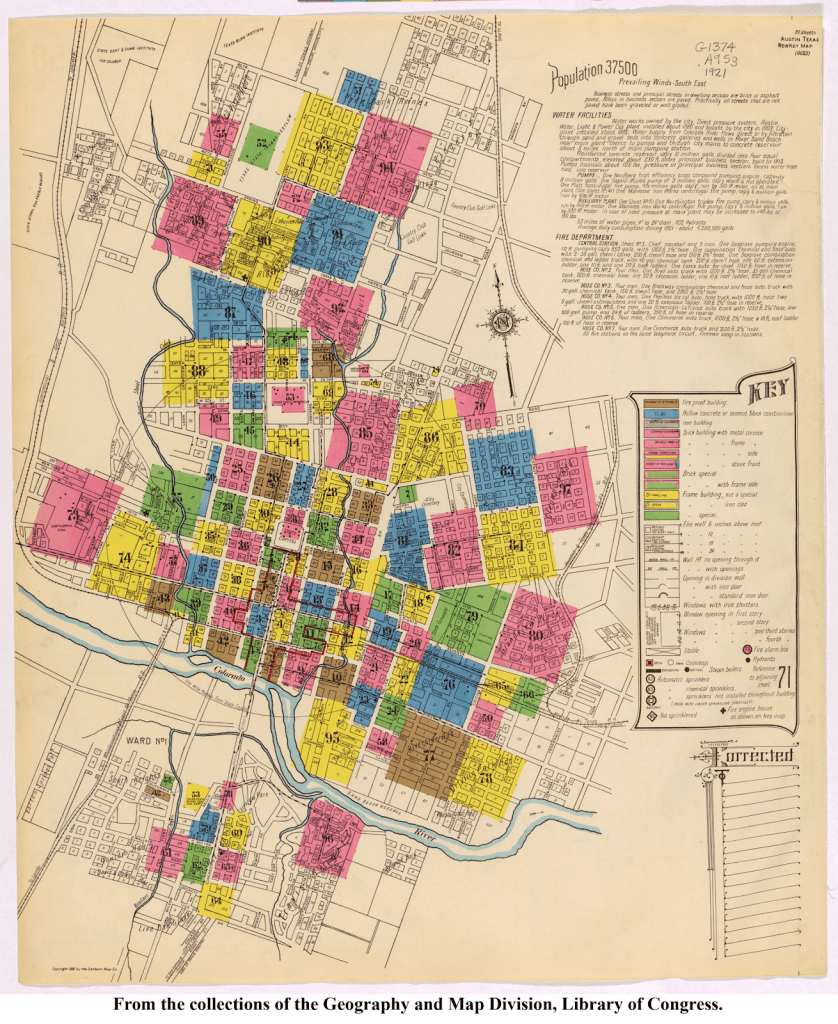
Although the date is missing in the Zilker marker, it notes that Zilker “indirectly funded school industrial programs when he sold 366 acres of parkland, including Barton Springs, to the city.”  The sale occurred in 1917.  The same year the heirs to the Pease estate, which spread from 12th street to 24th  street and from Shoal Creek to the Colorado River, decided to split the estate and develop it, dramatically spreading the city of Austin north and west (marked in black on the map).  This house was one of the first homes built in what would become the Enfield development.  Comparing the map above to the historic map below (although it is a few years newer), it is easy to see that the black neighborhood of Clarksville (marked in red and bordering the new development), sits precariously between the new park and the burgeoning neighborhood that spread Austin west of Lamar Boulevard.

Map of Austin, Texas depicting the city's various neighborhoods

In 1918, as the Clarksville marker notes, the Austin School Board closed down the Clarksville public school in one of the first attempts to move Clarksville residents east.  The decision by Austin’s school board, only a year after the single largest donation in their history, was not accidental.  The absorption of what is now Zilker Park and the Pease Estate into Austin pushed city borders westward, pulling Clarksville undoubtedly into the urban sphere.  The presence of a black neighborhood on the border of the soon to be wealthy and white neighborhood north of 12th street with the easy access to Zilker Park made their movement politically imperative in Jim Crow era Austin.

While the two years of 1917 and 1918 seem almost happenstantial in each individual marker, when read together they mark a significant turning point in Austin’s growth, as well as a distinct moment in Austin’s history of segregation.

Also in this series:

Mapping Austin’s Historical Markers

Similar series:

From There to Here


The views and opinions expressed in this article or video are those of the individual author(s) or presenter(s) and do not necessarily reflect the policy or views of the editors at Not Even Past, the UT Department of History, the University of Texas at Austin, or the UT System Board of Regents. Not Even Past is an online public history magazine rather than a peer-reviewed academic journal. While we make efforts to ensure that factual information in articles was obtained from reliable sources, Not Even Past is not responsible for any errors or omissions.
Mapping & Microbes: The New Archive (No. 22)

by Christopher Rose

Can the microbe speak?

It’s 5:30 pm, and I’ve been staring at my computer screen for over eight hours. There’s a crick in my neck, my breathing is shallow, my blood pressure has elevated, and the entire Giza governorate has just disappeared off of the map the instant that I finished tracing its borders—for the third time. I take a deep breath, utter a few choice unpleasant words under my breath, make sure to save my work, and turn off the computer. Today, the dragon has won.

I am two weeks into what I had originally, and naively, thought would be a one-week project to map the outbreak of epidemic and epizootic diseases in Egypt during the First World War, which comprises a subsection of my dissertation project. It’s not a great time to be working on Egypt, as it’s become nearly impossible to get research clearance from the Egyptian government. Funding has also become a near impossibility: my optimism at being named a finalist for a Fulbright in early 2016 was short lived; the program was suspended due to security concerns before awards were announced.

While online resources are scarce, I did find that the Egyptian government’s official gazetteer has an online index of its entire run since the 1870s. Over the course of several days, I discovered that the gazetteer was a virtual treasure trove of exactly the sort of data I’ve been looking for: reports of disease outbreaks in detailed locations up and down the Nile Valley. Over a week, I compiled a spreadsheet of almost 800 records for the period between late 1914 and mid-1919.

The question, of course, was what to do with this data. I was certain the diseases would tell me something, if I could just figure out how to get them to speak.

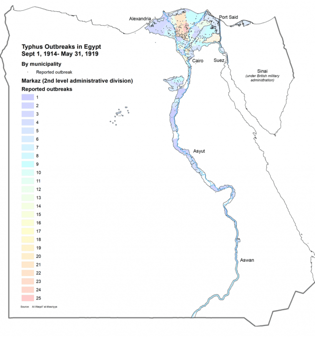
Map showing typhus outbreaks in Egypt, September 1, 1914 – May 31, 1919 (created by Chris Rose)

It was Julia Gossard, a UT alumna now teaching at Utah State University, who pointed me in the direction of the Programming Historian, a website dedicated to helping historians use digital tools to process data through modeling, mapping, and other methods. I didn’t have time to learn a programming language, but mapping was an idea I liked. The site has several columns about creating maps, using open source mapping software. While I’m a big fan of open source, especially when it replaces costly technical software, I was a bit uneasy about the lack of support for the platform – in short, I foresaw the ability to get myself into trouble, but not out of it.

A little digging around led me to the unexpected find that UT has an institutional subscription to ARCGIS, which is the (otherwise very expensive) industry standard mapping platform. Using UT’s institutional subscription to Lynda.com, I started training myself to use ARCGIS.

Had I known what I was getting myself into, I probably wouldn’t have dived right in.

Mapping the data required me to tag each record with the latitude and longitude of the reported location. This led me to one of the key stumbling blocks for all scholars of the Middle East who’ve dabbled in the digital humanities—so much data is out there on the web, but much of it is transliterated from the original language. There is no universally recognized Arabic-to-Latin transliteration method, and the potential inconsistencies are well on display in the web’s largest open-source geographic database, Geonames.org. While some of its Egyptian entries contained the original names in Arabic script, most did not, leaving me to guess—frequently incorrectly—how they might have been rendered. Since Geonames is open-source, I added the names both in Arabic and one of the more commonly recognized transliteration systems to Geonames’s database as I went, which will hopefully make someone else’s life a little easier.

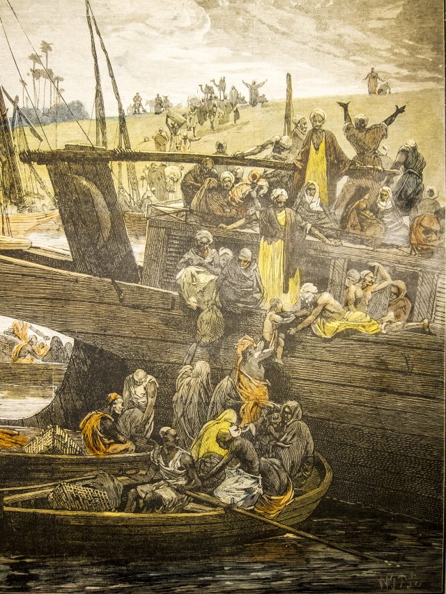
People fleeing a cholera outbreak at the port of Boulaq (near Cairo) in 1883 (via Wellcome Collection)

Finally, it was time to start mapping, and herein lay another challenge. ARCGIS has an expansive built in library of open source data, which included, as I had hoped, administrative maps of Egypt. I very quickly realized, however, that the administrative borders of the early 21c did not correlate directly to those of the early 20c. At least one governorate has since been split into three and there were a lot of unfamiliar names on the maps. I discovered that the UT Libraries has a copy of the 1917 Egyptian census, which has a big fold out map of the country. I scanned it, brought it home and compared it to the current maps … and realized that it was probably going to be easier to draw the 1917 map in ARCGIS rather than try to adapt the contemporary maps.

The process took nearly two weeks, employing long forgotten Photoshop skills (yay for bezel curves!), tracing a century old map and rendering it onto a satellite image of contemporary Egypt. The resultant map is, as they say, “good enough.” It’s probably got a distortion of around 2 miles, but it’ll never appear in print at that level of detail. Maybe when my monograph becomes a best-seller, I’ll hire someone to re-draw it.

I learned that ARCGIS has some quirks. It has a tendency to freeze up every 60-90 seconds. I quickly learned to save my work every time I did anything, a lesson that came in handy when, for some reason, the entire Giza governorate vanished inexplicably … three times … after I drew it. (The following morning, I discovered that the governorate hadn’t vanished, it was just invisible. I still don’t actually know why).

Finally, the big day came. After the blood, sweat, tears, swearing, and yelling at the cat, the map was finished. I overlay my disease data, and sat back to look at the results.

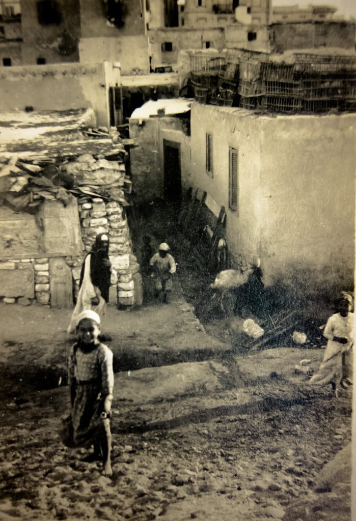
Children playing in a poor neighborhood of Alexandria under quarantine during an outbreak of typhus, sometime around WWI (via Wellcome Collection)

Have the microbes told me a story? They have. As I set forth on the next phase of my project, I have clusters of locations and specific dates to look for. But the maps have also given me more questions—Is there a correlation between a two-year outbreak of cattle plague and the rampant inflation in the cost of food during the war? Does the death of 139,000 Egyptians due to influenza at war’s end have anything to do with the eruption of a populist uprising just six weeks later? And why is this most deadly epidemic absent from the press and the pages of the official gazetteer?

I also realized the importance of presenting my data in this visual form. No one is going to go through all 800 records on my spreadsheet, but the map provides a clear snapshot of my subject and the questions it raises, and it makes a visual case for the argument I’m laying out in my dissertation. In this form, it will make my modest contribution to this field of study more convincing and accessible.

The New Archive series highlights various uses of digital tools in humanities research. More from the series:

Charlie S. Binkow explores Honest Abe’s Archive
Joseph Parrott highlights the digitalized political posters collected by archivist and artist Lincoln Cushing
Maria José Afanador-Llach discusses her experience at a Digitilization Workshop in Venice
Daniel J. Cohen and Roy Rosenzweig, Digital History: A Guide to Gathering, Preserving, and Presenting the Past on the Web

You may also like:

Hanan Hammad on gender in a small town in Egypt
Martin Thomas and Richard Toye discuss the Dreyfus Affair and the Fashoda Crisis of 1898
Cali Slair on the eradication of smallpox

Digital Teaching: Mapping Networks Across Avant-Garde Magazines

In “The European Avant-Garde in Print” (REE 325), students explored the unique and vibrant print culture in Central Europe between the two world wars and the social and political context that produced it. I sought to expose students to the networked qualities of magazines that were published in Czech, Hungarian, Serbo-Croatian, Polish, and German. We examined contributor lists, the aesthetic qualities of the “New Typography,” and the way that the magazines cross promoted each other through advertisement.

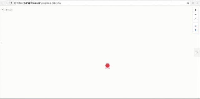
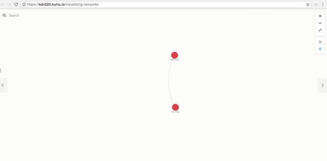
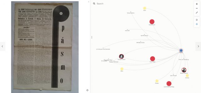
Students discovered the transnational and multilingual interconnectivity of these magazines through the use of various digital mapping and open source publishing resources, such as Kumu and Scalar. Using Kumu’s Social Network Analysis tool, for instance, I could help students visualize how one figure, such as Karel Teige, the leading member of the leftist Czech avant-garde group Devětsil, leveraged his connections with editors elsewhere to make magazines that facilitated relations with major figures of a pan-European avant-garde. To offer just one example, through the Brno-based magazine, Pásmo, the Czech avant-garde actively collaborated with the Russian born and Berlin-based artist El Lissitzky, the German Bauhaus director Walter Gropius, and French-German correspondent Yvan Goll.

(via author)

I used digital mapping in my lectures  to make this fluid exchange more concrete and dynamic for students.  Then, a major component of the class was built around students developing their own digital mapping and visualization group projects. In this way, students had the opportunity to engage critically and interactively with the materials covered in the course.

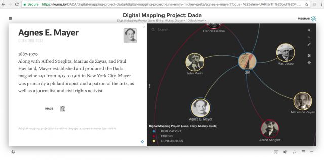
One group drew on our extensive discussion of Dada periodicals published both in Europe and the United States—which we had the opportunity to view in person at the Harry Ransom Center—to reveal how some prominent artists appeared in Dada publications on both sides of the Atlantic. They also used their map to comment on who did not figure in these publications—namely, women, with the exception of the New York-based 291 contributor Agnes Meyer, whom they featured.

(via author)

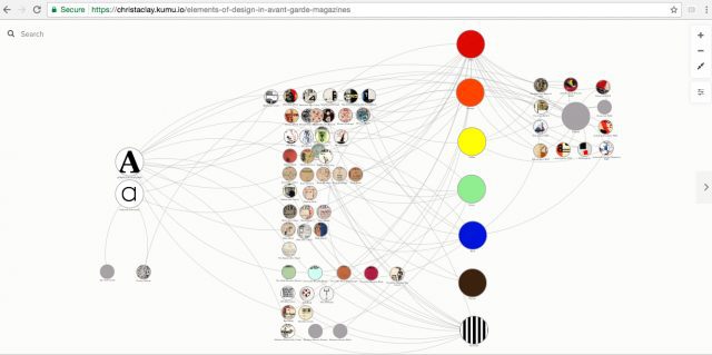
Another group of students chose to document connections across a series of publications not via their contributors or geographic locale, but rather in relation to shared principles of design, such as color, shape, and textual form. This group even built their map to visually reflect in its own design the various components that they chose to highlight.

(via author)

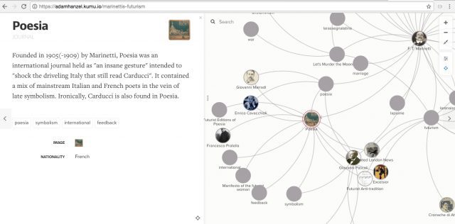
Another project focused on a single magazine—the Italian Poesia—to make manifest the various personal connections between the leading figure of Italian Futurism, F.T. Marinetti, and other artists and authors related to the movement.

(via author)

The digital mapping component of the course was largely made possible with the assistance of UT’s Slavic and Digital Scholarship librarian, Ian Goodale, who made multiple class visits in which students had the opportunity to workshop their digital projects, and who also held weekly office hours in the Slavic Department. Ian also created a Scalar platform that holds all the mapping projects in one place, with the Kumu maps embedded, and includes other analytical content generated by students, allowing for further connections to be drawn across the group projects.

I observe in my own classroom, and in the work of my peers both across UT and at other institutions, the need for universities and colleges to commit to allocating funding for their libraries so that they may train and hire staff who are able to support digital pedagogy. For example, this past semester, Ian Goodale also helped my colleague in the Slavic Department, Vlad Beronja, create another digital project, Yugoslav Punk, with students in his course on Punks & Divas in Southeastern Europe.

Another aim in teaching “The European Avant-Garde in Print,” was to expose students to non-European periodicals, to explore the variety  of responses to inter-war social and political conditions, and also to find actors outside of a European male cohort largely not represented in the Central European set. By giving students the opportunity to create their own mapping projects, I hoped to reveal unexpected connections between these cultural products. There is more work to be done in achieving these goals in a future iteration of this course, and data visualization and digital mapping tools will facilitate students’ active learning towards this end.

You may also like:

Digital Learning: Starting from Scratch, by Joan Neuberger
Media and Politics From the Prague Spring Archive, by Ian Goodale
The Prague Spring Archive Project, by Mary Neuburger and Ian Goodale

_________________________________________________________________________________________

The views and opinions expressed in this article or video are those of the individual author(s) or presenter(s) and do not necessarily reflect the policy or views of the editors at Not Even Past, the UT Department of History, the University of Texas at Austin, or the UT System Board of Regents. Not Even Past is an online public history magazine rather than a peer-reviewed academic journal. While we make efforts to ensure that factual information in articles was obtained from reliable sources, Not Even Past is not responsible for any errors or omissions.
History of Modern Central America Through Digital Archives

By Vasken Makarian

What happens when historians take a pause from using archives to write history and instead delve into the science of producing digital archives? If you are a traditional historian, you might cower at the bombardment of technological know-how that comes your way. Look a little closer however, and you soon find that archival science is an intellectually and theoretically rich field. Engaging with digital archives and digital history is a great way for scholars to re-think how they and archivists alike, select, categorize, and publicize historical data for educational and scholarly purposes. As historians increase their use of digital platforms, it can be helpful for all historians to take a step in the archivists’ shoes.

In the spring of 2016, students of Dr. Virginia Garrard’s course, “History of Modern Central America through Digital Archives” had this opportunity. The course bridged traditional historiography with an introduction to digital archives and digital history. Students came from a wide array of disciplines, from Information Studies to History. For their final project, they could choose between writing a traditional research paper or designing a digital history project, or both. This mix of both worlds allowed for a hybrid conversation that melded traditional historical debates with sensitivity to the way scholars and archivists produce and organize knowledge.

Biblioteca_Nacional_de_Guatemala_Luis_Cardoza_y_Aragón

The National Library of Guatemala, a more traditional place for historians to conduct research (via Wikimedia Commons).

Students eager to get up-to-date with newer digital history platforms were not disappointed. Homework assignments ranged from digital primary source scavenger hunts to analyzing pre-established digital scholarly interfaces, such as the Latin American Digital Initiatives Collection (LADI). The class introduced students to up-to-date digital projects like interactive maps, self-correlating databases, and archival metadata. Students also worked in groups to grapple with the challenges of making digital archives more accurate and efficient.

One of these challenges involved selecting the right “subject terms” that help users search for content in digital databases. To facilitate the search process, students needed to produce terms that were neither too narrow nor too broad, and that represented the “aboutness” of their subjects. Just how efficient, accurate, and unbiased these terms appeared influenced the way users would receive and write about history. In one instance, I had to produce English subject terms for a short and vague Guatemalan newspaper about a desaparecido or forced disappearance. Choosing between terms like “assassination,” “murder,” and “homicide” prompted me to scrutinize the meaning, political implication, and contextual relevance of each term. These questions added a nuanced perspective to my research as well.

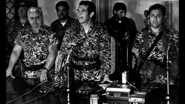
maxresdefault

Forced disappearances were common during the Guatemalan Civil War (via YouTube).

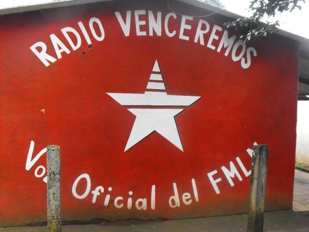
A less somber yet strangely satisfying task involved creating a sound bite archive from Radio Venceremos—an underground anti-government radio program from 1980s El Salvador. Here, students created an archive of background noises: shouts, singing, frogs, birds chirping, gunfire, alarms, helicopters, and static. Rather than paying attention to content, they recorded language dynamics, the environment, and materiality. This innovative way of organizing data allowed them to get at more subtle information, such as timing, emotion, background events, secrecy, and level of danger. This was detective work at its finest and “tech-savvyist.”

Radio_Venceremos

Outside of the Radio Venceremos studio (via Wikimedia Commons).

Of course, walking away with new skills in digital media was not the be-all and end-all. Thinking more deeply about digital archives illuminated urgent theoretical questions relevant to scholars and archivists alike. To whom do historical records belong? What biases do archivists and scholars convey when presenting data? Do living (or even dead) historical actors want others to publicize information about them? How do we reconcile the desire to uncover histories, with the risks and inconveniences public knowledge poses for historical actors and their communities?

Personally, this course contributed to thinking about my dissertation on Guatemala’s recent civil war, which spanned from the 1960’s to the 1990’s. The legacy of the civil war carries over to present-day Guatemala and presents political and ethical roadblocks to the publication and presentation of records. Emerging data may appear rich for archiving, as the recent Guatemalan National Police Historical Archive demonstrated. However, historical records are living things that carry emotional, political, and economic consequences for present-day actors. As this course demonstrated, archives are anything but a mere compilation of sources. They require much human configuration, strategic organization, and logistical coordination. On the other hand, they demand sensitivity to the ethical, political, and intellectual problems of producing knowledge.

bugburnt
You may also like:

Virginia Garrard-Burnett on La Violencia in Guatemala.
John McKiernan-González tells the story of the first nationally distributed Latino-themed public radio show in the United States.
Charley Binkow discusses the online archives of the 1914 Easter Rebellion in Ireland.
bugburnt

Virtual Auschwitz

By David Crew

Document1

Ralf Breker wearing the VR headset in front of his VR view of Auschwitz (via BBC News).

The Bavarian State criminal office (LKA) in Munich, Germany has developed a 3D virtual reality model of the infamous Auschwitz concentration and extermination camp to be used in trials of Nazi era war criminals who still remain alive. Drawing upon original blue prints, laser scans of remaining buildings and contemporary photographs, this VR model allows prosecutors, judges and lawyers to view Auschwitz from almost any angle.  The digital imaging expert, Ralf Breker, who developed this technology says that it can be used, for example, to determine whether someone who was a guard in Auschwitz in  a specific  watchtower could or could not see crimes committed in another part of the camp. Breker thinks the technology he developed will soon be used in other types of criminal proceedings because it allows investigators to re-create crime scenes that no longer exist as they were when the crime was committed.  He hopes, however, that when the German legal system no longer needs his 3D model of Auschwitz, it will be given to a museum so that it does not fall into the hands of anyone wanting to turn it into a computer game.

For further details and an interview with Ralf Breker, see

Marc Cieslak, “Virtual reality to aid Auschwitz war trials of concentration camp guards”
bugburnt
Also by David Crew on Not Even Past:

The Normandy Scholar Program on World War II.
The Years of Extermination: Nazi Germany and the Jews, 1939-1945 by Saul Friedländer (2007).
Normal Pictures in Abnormal Times.
bugburnt

The Prague Spring Archive Project

By Mary Neuburger and Ian Goodale

The Prague Spring Archive project, a collaboration between the Center for Russian, East European, and Eurasian Studies (CREEES) and UT Libraries, is now live. This open access online archive is the first step in a longer-term initiative by CREEES Director Mary Neuburger to digitize significant collections of primary documents from the the Lyndon Baines Johnson Presidential Library that shed light on the Cold War. While select documents from the LBJ collection can already be found online, CREEES is working to digitize National Security country files from the former Eastern Bloc in their entirety. Because these documents are open record, the LBJ Presidential Library has allowed unlimited scanning and open access presentation of such documents. The hope is that they will appeal to a wide and inclusive audience of students, instructors, scholars, and the general public.

PSAP

Phase One of this project, largely comprised of National Security Files on Czechoslovakia, is nearly complete. The bulk of the documents in this collection focus on the so-called “Czechoslovak Crisis,” otherwise known as the Prague Spring, and its aftermath. The Prague Spring was one of the most dramatic and popular experiments in Communist Party reform, which took place in Czechoslovakia beginning in January 1968, only to be crushed by an invasion of Soviet and Warsaw Pact troops on August 21 of the same year.  This event was a major turning point in the Cold War and the history of communism more generally as the wave of reforms brought such a high degree of hope and enthusiasm and its suppression precipitated such deep disillusionment in the region and among the global left. It was the end, in a sense, of any hope for the communist system to be reformed and as such could be seen as the beginning of the end for the system itself.

The LBJ Library documents on Prague Spring are a treasure trove for historical research as they chronicle the event through detailed intelligence reports and day-by-day commentary by US policy makers. They include briefs on global reactions to the crisis, which many at the time thought could precipitate World War III. These documents are valuable both from a US policy standpoint and for a deeper understanding of the events and developments within the region itself. As the documents are all in English, they have the potential to be used for everything from academic historical research to student research.

Helsinki_demonstration_against_the_invasion_of_Czechoslovakia_in_1968

Helsinki demonstration against the invasion of Czechoslovakia in 1968 (via Wikimedia Commons).

Ian Goodale, the new Russian, East European, and Eurasian Studies & Digital Scholarship Librarian, worked closely with graduate students from the School of Information at UT Austin and undergraduate students from CREEES to photograph the documents in the reading room at the LBJ. He then collaborated with the UT Libraries to process the images into archival-quality PDFs for ingestion into Texas ScholarWorks, the university’s digital repository. These PDFs were made machine-readable so that they are full-text searchable in the repository and Ian worked to create extensive metadata for each document to make the collection more discoverable. Finally, the students in Mary Neuburger and Vlad Beronja’s Graduate Seminar on Russian, East European and Eurasian Studies worked with Ian over the last semester to create a guide to the collection. Ian did an amazing job of building a Scalar website as a portal for the guide, which provides summary descriptions of most of the folders and specific links to some of the most interesting documents.

Careful attention was paid to making the site accessible both to academic researchers and to patrons conducting personal or non-academic research, with additional features planned that will extend the breadth of the site’s audience. A module that will include materials aimed at high school and middle school teachers and students, including sample lesson plans and educational activities, will be added in the future. For researchers who would like to explore what is available in the physical collections of the LBJ Library, the finding aid for the entire archival collection is also available on the site.

3362326082_18f89a5a8a_b

UT CREES is located in Burdine Hall (Zug55 via flickr).

The Prague Spring Archive portal is a resource that will continue to grow, with new content and features continually added and expanded upon. By providing open access to important primary source materials, the project will continue to contribute to international scholarly communities, utilizing practices and tools of the digital humanities to freely share its content in an attractive, easily navigable portal.

Digitization work on the larger Cold War project is ongoing, with new materials currently being photographed, processed, and added to Texas ScholarWorks by graduate student Nicole Marino and Russian, East European, & Eurasian Studies and Digital Scholarship Librarian Ian Goodale.

bugburnt
More by Mary Neuberger on Not Even Past:
Balkan Smoke: Tobacco & Smoking in Bulgaria.
The Museum of Sour Milk: History Lessons on Bulgarian Yogurt.

You may also like:
Restless Youth: The CIA, Socialist Humanism, and Yugoslavia’s 1968 Student Protests.
bugburnt

Digital Teaching: From the Other Side of the Screen: A Student’s View

By Abigail Griffin

When most college students think of online courses, they often imagine basic, boring classes that are convenient and easy A’s. Online classes often require little effort and minimal time commitment, while still satisfying a graduation requirement. So, students drudge aimlessly through the mandatory course, get their completion grades, and move on with their lives, without actually gaining anything from the experience. Dr. Suri’s online course, however, is so much more than a mark off of an undergraduate’s to-do list. Professor Suri revolutionizes this old, bland style of online coursework and provides a unique and active learning experience to students anywhere—from the comfort of their own beds to a quaint coffee shop down the street to the studio classroom in Mezes.

griffinblog

Going into the course, I was skeptical. Not because I didn’t have full faith in Professor Suri’s ability to make the course the best it could be, but because I was worried that even the best online class could not beat traditional, classroom-style learning. I had been unimpressed by the reputation of online classes in the past, and I never previously had the desire to take one. I always preferred a classroom setting because it just seemed more “right.” But boy, was I wrong.

Not only is Professor Suri an incredibly energetic and knowledgeable professor, but he makes his lectures engaging, informative, and entertaining. The online setting does not take away from the education at all, in fact, I think it enhances the learning environment. Students are more willing to participate in class through applications like “Class Chat” and “Ask the Professor,” and the TA’s and Prof. Suri actively respond to their comments, which would be nearly impossible in a huge lecture hall. When students take an active role in their learning like this, they benefit significantly more from the lecture. I know from experience that there is practically no class participation in a 300-500 person lecture hall, but having the same class size online encourages significantly more student involvement.

For example, Dr. Suri uses images in his lecture every class period, and the pictures pop up on our video screens so we can easily see them. When he asks us to comment on the images, students begin contributing to the discussion in a matter of seconds. In a normal classroom setting with the same number of students, almost no one responds to the professor’s questions, and never that quickly and eagerly. So the online forum actually makes the lecture easier for the students, the professor, and his assistants. It is also wonderful because the slides and images that come up on our screen are clear and easy to understand and interpret, whereas, it would be more difficult for some of the students to evaluate the images in a lecture hall.

Overall, I am incredibly impressed by what Dr. Suri has done with his online course. Obviously, it isn’t perfect. Sometimes the technology doesn’t work correctly or people get off track in the class chat. But as a whole, the class is a lot of fun. I think that the online and in-person office hour options are great, the class pings ensure that students are paying attention (and are super easy participation points), and the lectures are always interesting.

Plus, I have never been a morning person, so it’s great to be able to wake up 5 minutes before class and still make it on time.

bugburnt

Abigail Griffin is a second-year Plan II Honors and Government double-major with a minor in Arabic. She graduated high school in St. Louis and her family currently resides in Elizabethtown, KY. She is an Arabic Flagship and Forty Acres scholar at UT , an Agency Co-Director within Student Government, and a Camp Texas counselor to incoming freshman. Abigail also volunteers as a KIPP tutor and as an AISD tutor to Arabic-speaking students. Additionally, she is passionate about sports and has played on the Women’s Club Soccer team In the future, she intends to pursue a career in foreign service and counterterrorism. 

2016-02-28 14.30.31

bugburnt

Next Page »

Recent Posts

  • NEP’s Archive Chronicles: A Brief Guide Through Some Archives in Gaborone and Serowe, Botswana
  • Review of Hierarchies at Home: Domestic Service in Cuba from Abolition to Revolution (2022), by Anasa Hicks
  • Agency and Resistance: African and Indigenous Women’s Navigation of Economic, Legal, and Religious Structures in Colonial Spanish America
  • NEP’s Archive Chronicles: Unexpected Archives. Exploring Student Notebooks at the Institut Fondamental d’Afrique Noire (IFAN) in Senegal
  • Review of No Place Like Nome: The Bering Strait Seen Through Its Most Storied City
NOT EVEN PAST is produced by

The Department of History

The University of Texas at Austin

We are supported by the College of Liberal Arts
And our Readers

Donate
Contact

All content © 2010-present NOT EVEN PAST and the authors, unless otherwise noted

Sign up to receive our MONTHLY NEWSLETTER

  • Features
  • Reviews
  • Teaching
  • Watch & Listen
  • About