• Features
  • Books
  • Teaching
  • Digital & Film
  • Blog
  • IHS
  • Texas
  • Spotlight
  • About

The past is never dead. It's not even past

Not Even Past

Crafting a Republic for the World in 19c Colombia

by Lina del Castillo

The powerful myth of ‘American exceptionalism’ would have us think that the United States alone offered the world universal ideals of democracy, self-determination, and shared prosperity. However, if we open our eyes beyond canonical nineteenth-century writers such as Alexis de Tocqueville, an alternate story emerges. The long-ignored yet staggering number of works by publicists, historians, geographers, novelists, economists, and jurists from Caracas, Bogotá, Santiago de Chile, Buenos Aires, Mexico, Quito, and Lima begin to reveal the remarkable dimensions of modern republican experiments in Spanish America.Early republican experiments in Spanish America occurred at a time when there were no models to follow. While republicans in Europe battled monarchists and the clerical old regime, while they increasingly imagined their republics as colonial empires of racial inferiors, and while republicans like Thomas Jefferson and James Madison in the United States built their republic on white supremacy and industrialized slavery in cotton plantations, a generation of Spanish American sociologists, economists, anthropologists, and political philosophers became the world’s republican vanguard.

One of their most resilient inventions was rhetorical. Spanish Americans consistently portrayed the period of Spanish rule as obscurantist, tyrannical, and corrupt. This discourse of Latin America’s “colonial legacies” is pervasive today. During the early nineteenth century, Spanish Americans invented distinct “colonial legacies” to legitimize their intellectual and political work in rejecting Spanish rule. They believed science could diagnose, treat, and excise those pernicious colonial legacies. Their radical new form of political modernity required they take a systematic approach to understanding and changing their society, their economic structures, and their political processes. As perceived obstructions changed over time, so did proposed solutions, which in turn contributed to the invention of new philosophies, anthropologies, sociologies, geographies, and sciences.

José María Samper (Cultura Banco de la República).

The case of a little-known Colombian jurist and writer, José María Samper, illustrates this creative process. Samper posed hard questions to both Europeans and U.S. Americans as he wrote about the history of Colombia while traveling through Europe from 1858 to 1862 with his newly wedded wife, Soledad Acosta de Samper. With so many innovative studies by Spanish Americans available, Samper wondered why Europe remained deaf to the socio-political complexity and innovation of Spanish America. He knew the unfortunate answer: the confounding noise produced by the political storms that crashed through Spanish America during the first half of the nineteenth century. Narratives about chaos, violence, and caudillos drowned out any discussion about how these republics were experimenting with democracy, sovereignty, universal male suffrage, republican equity, and self-determination.

Map of Nueva Granada, 1832-1855 (Carta XII del Atlas geográfico e histórico de la República de Colombia, 1890. Wikipedia)

Samper represented a generation who creatively re-imagined republicanism for New Granada (a polity that encompassed roughly today’s Colombia and Panama). He, along with hundreds of other men in the emerging republic, formed the Caldas Institute (Instituto Caldas) in the late 1840s. This scientific society crossed the political spectrum and championed a circulatory ideal for New Granada. The circulation of people, goods, and ideas would undo the supposed Spanish colonial legacy of fragmentation and exploitation of territories that led to stagnation and poverty locally. Rather than foment export-led growth on the backs of enslaved people, a range of government officials from an array of provinces instead focused on identifying and strengthening the internal circulation of goods and services. Provincial chapters quickly formed and worked to identify what industries needed improving, how to ensure proper morality, and where infrastructure needed to be built. Circulation of people, goods, ideas, and credit was further supported by steamship navigation along the Magdalena River flowing through the newly created Puerto Colombia in Barranquilla, a port intended not just for export but also internal circulation among New Granada provinces.
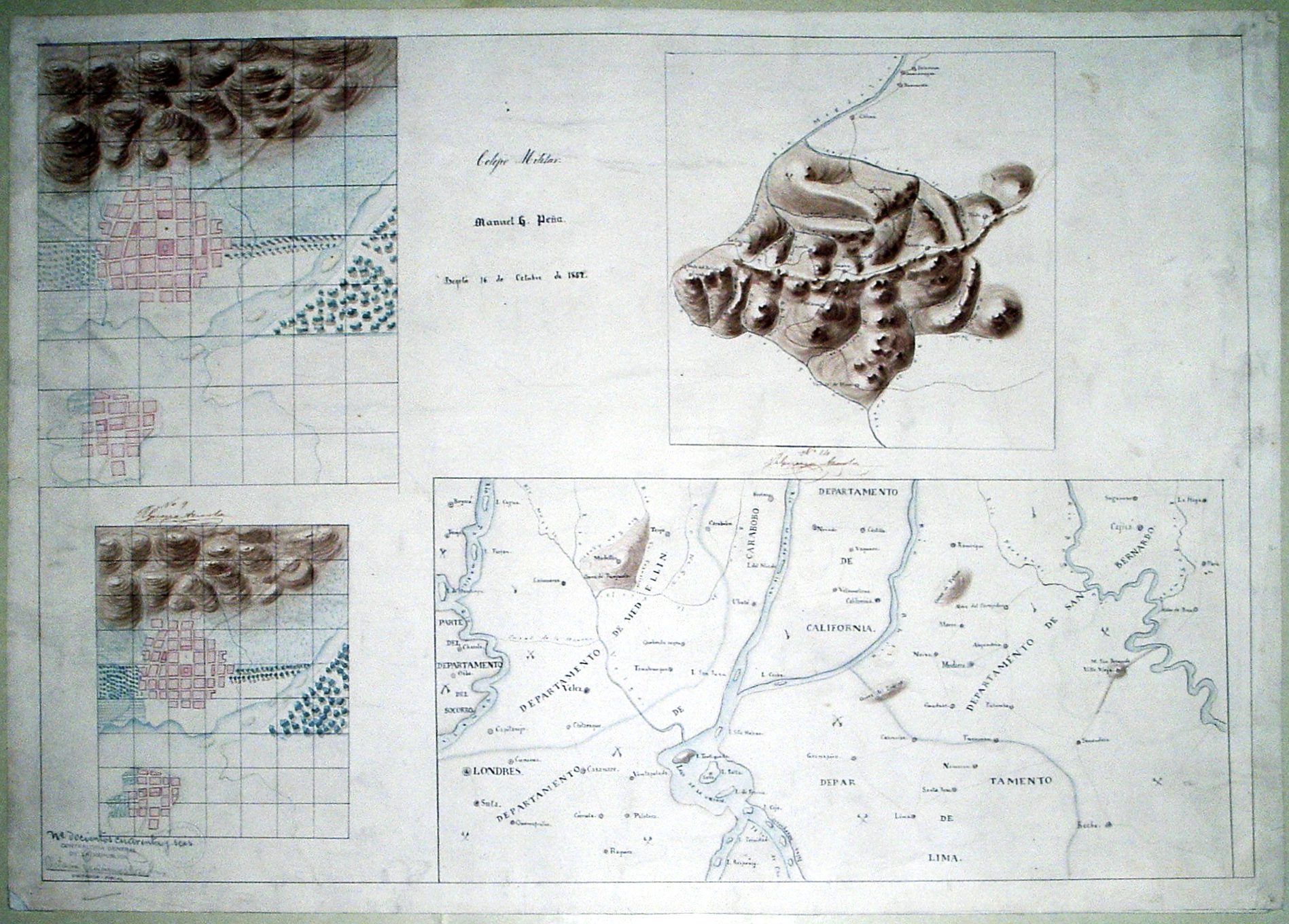
Manuel Peña’s maps.

Caldas Institute members also helped identify the brightest minds from the provinces. Those young men won scholarships to attend New Granada’s military school in Bogotá. Cadets learned new mapping techniques from foreign experts through apprenticeship. As revealed by the fanciful imaginary landscape drawn by sixteen-year-old Manuel Peña, cadets learned to express the implications of local and global circulation for the Republic. Consider how Peña’s map drew together California, London, Lima, and Carabobo, along with existing New Granada cities and towns such as Medellin, Socorro, Vélez, Oiba, and Cajicá. All these places, according to Peña’s cartographic imaginary, also participated in a war for liberation as signaled by crossed swords strewn throughout the territory.

The ideal of free circulation to combat a colonial legacy of fragmentation, exploitation, and economic stagnation helps us better understand why early republicans in New Granada not only moved towards the abolition of slavery by 1851, but also worked tirelessly towards identifying the best routes for canals and roads. The circulation of free people, ideas, and trade required infrastructure that could traverse the Andean mountainous terrain, after all. The Chorographic Commission, first conceptualized by members of the Caldas Institute, was to bring to fruition New Granada’s long-term development projects. The work this scientific expedition carried out from the 1850s through the 1860s was deeply entwined with the development of a republican political ideology based on the abolition of slavery and experimentation with universal male suffrage.

Agustín Codazzi of the Chorographic Commission camping with his collaborators in Yarumito, Soto Province (1850, Biblioteca Nacional de Colombia, Colección Comisión Corográfica. Wikipedia).

While some Caldas Institute members engaged in such remarkable experiments with republican circulation, others experimented with what José María Samper termed the science of constitutionalism. Their work culminated in the constitution of 1853, which was radically democratic even by today’s standards. No electoral college would get in the way of the will of the people. In the wake of slavery’s abolition, presidents were directly elected through universal male suffrage, as were all representatives of Congress, members of the Supreme Court, and provincial governors. The 1853 constitution also permitted the provinces of New Granada to develop their own charters, and a flurry of constitution writing ensued. The most remarkable of these was that of Vélez, which granted universal suffrage to women as well as men. The 1853 constitution proved such a radical re-working of the democratic system that Civil War broke out. The devastation was overwhelming. An alternate constitutional plan emerged, also led by José María Samper, that vested sovereignty in the states rather than individuals. These were the kinds of constitutional experiments Samper and his cohort shared with the world.

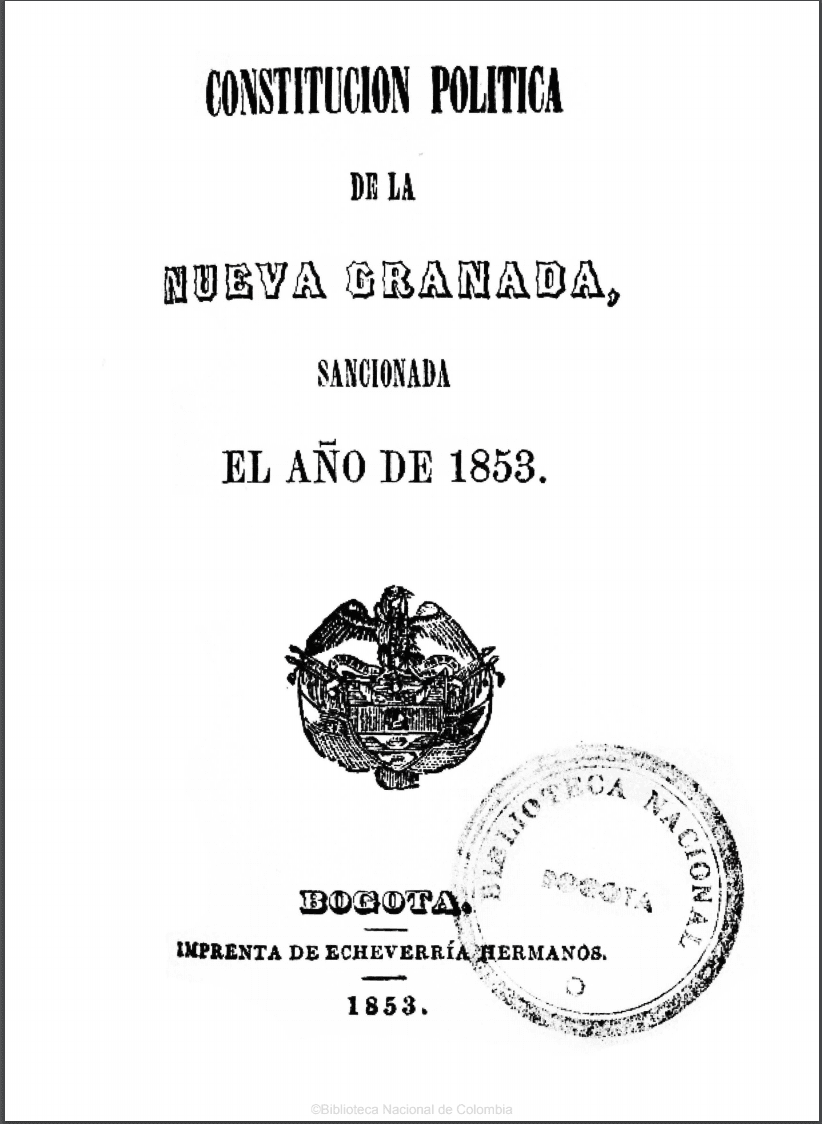
Cover page of the Constitution of 1853.

Spanish Americans have too often been simplified as either detached racist elites with little knowledge of local realities looking only to profit from export led growth at any cost, or violent anti-democratic caudillos. De-exoticizing Spanish American thinkers allows us to take their early republican projects – and their discontents– seriously.

Highlighting the nineteenth-century invention of colonial legacies also allows us to begin to question why thinkers, writers, scholars, and educators in the United States, in the wake of independence, did not create the category of colonial legacies for themselves. Why did they not identify legacies of British rule that needed to be rooted out in order to produce a republic of equal citizens, no matter their race? Why, indeed, can we see colonial legacies so easily for Spanish America, but we have such a hard time identifying the persistent colonial legacies that continue to make universal democracy and shared prosperity in the United States so difficult to achieve?

Lina del Castillo, Crafting a Republic for the World: Scientific, Geographic, and Historiographic Inventions of Colombia (2018)

Further Reading:

James Sanders, The Vanguard of the Atlantic World: Creating Modernity, Nation, and Democracy in Nineteenth-Century Latin America (2014).
Sanders underscores how republicans in Colombia and Mexico, but also other republics such as Chile, Uruguay, and Venezuela, saw themselves as shaping political modernity in the world.

Nancy Appelbaum, Mapping the Country of Regions: The Chorographic Commission of Nineteenth-Century Colombia (2016). This focused study on the Chorographic Commission in Colombia reveals the richness and complexity of that state-sponsored scientific expedition.

Mauricio Tenorio-Trillo, Latin America: The Allure and Power of an Idea (2017).
Tenorio-Trillo offers a short essay on why the idea of Latin America has proved remarkably resilient since the mid-nineteenth century.

Hilda Sabato, Republics of the New World: The Revolutionary Political Experiment in Nineteenth-Century Latin America ( 2018).
Sabato’s book effectively describes the fundamental innovation of Latin American politics in the nineteenth century as the revolutionary decision to adopt popular sovereignty as the founding principle of the polity and as the only source of legitimate power.

José M. Samper, Ensayo sobre las revoluciones políticas y la condición social de las repúblicas Colombianas (Hispano-Americanas); con un apéndice sobre la orografía y la población de la Confederación Granadina  (1861/2018).

Top image: Watercolors by Manuel María Paz, a member of the Chorographic Commission: A Bridge on the Ingara River (L), The Village of Tebada (M), The Square of Quibdo (R), Chocó Province (World Digital Library).

Austin Historical Atlas: Mapping Austin’s Historical Markers

(Preview of our first page: “Austin Development During World War I”)

By Jesse Ritner

In recent years, discussions of Confederate monuments have dominated narratives of public memory in the United States. As important as this discussion is, however, Civil War monuments make up a relatively small percentage of historic markers in American cities.  Although less contentious, state and national historic markers polka dot our city-scapes, quite literally inscribing in bronze information about the city’s past on our buildings, street corners, and in our urban parks.

Often these markers seem inconspicuous.  Many list the names of long dead citizens, or remark on the importance of architectural styles far beyond the working knowledge of casual perusers.  However, these marked places do not exist in a vacuum.  Their importance relies on their relationships to other buildings and to the city at large.  Yet, that relationship is hidden.  The markers speak, when we learn their language, about important aspects of a city’s collective history, even about histories that the marker makers never intended to reveal.  Our hope, at Not Even Past, is to make these connections visible through a series of maps which we are calling a digital atlas.  In the process we will see what unexpected information might be revealed by the historical markers in our home city of Austin, Texas.

A black and white map of Austin, Texas focusing on the city's downtown area
Map of Austin in 1920 (via Wikimedia)

This will by no means be the first digital map of historical markers in the city of Austin.  The Texas Historical Commission offers its own map of markers, which naturally include our city.  Google Maps has a limited version, along with Stopping Points, and numerous other websites.  These maps tend to be thorough, covering relatively reliably the markers they promise, and usually offering addresses, marker titles, and occasionally the marker text (as well as limited and unreliable descriptive metadata).  In the case of the Texas Historical Commission they even offer thematic maps (i.e. Women’s History, African American History, Education, etc.).

The Austin Historical Wiki, from the UT departments of Architecture and Historic Preservation, take on important issues in the field of preservation.  How do places get preserved, and how can open sourced maps (in this case a Wiki) help to utilize historical markers more effectively? How can we discover what the community wants from their markers, rather than reflecting the desires of a wealthy, motivated, and organized few?  (To read their fascinating reflections on the project click here.)  Their goals are both admirable and important.  Nevertheless, the Austin Historical Wiki, much like these other mapping initiatives, fail (or perhaps more accurately do not attempt) at our goal of providing historical context to often bland and obtuse historical markers scattered throughout the city.

A contemporary map of the City of Austin, Texas
Contemporary Map of the city of Austin (via Wikimedia)

Historians are slowly learning from geographers, anthropologists, architects, and many others how to mine historical information that can be found in landscapes.  Geographers and architectural historians are especially good at finding and relaying information on materials, whether it be the type of granite used for the Texas Capitol Building, or the way in which the Balcones Escarpment provides Austin with reliable water during dry seasons.  Historians, in contrast, specialize in creating narratives out of historical information.  By combining these methodologies of space, data, and narrative voice with technologies such as GIS (Geographical Information Systems), historic markers can reveal a more interesting and comprehensible history of Austin that is already written onto the city.

The goal of our Digital Atlas is a map that can be viewed in layers, allowing connections to be drawn between different markers.  This may involve comparing a number of markers that occur in the same year (our first post will be about three markers related to 1917), or it may be something more familiar, in that markers are arranged and colored to allow us to see how women’s lived experience has changed over time.  We will release these layers slowly, month by month.  Some may include only a few historical markers, while others could utilize ten, twenty, or thirty.

To begin, the maps, while interactive in a limited capacity, will not necessarily help people make connections between markers on their own.  However, as layers increase, and more and more markers are entered in our Digital Atlas, we hope to create a map large enough, and with sufficiently searchable metadata, so that the map could be used as a teaching tool in classrooms, as well as a way to discover more about Austin for the curious reader.

An image of the Texas Historical Commission Plaque for the First Classes of the University of Texas Law School
Example of Texas Historical Commission Plaque (via Wikimedia)

The goal of this mapping project is not fully formed.  We want to visualize the cityscape, historically contextualize existing markers, challenge existing narratives, and identify events and people who deserve to be commemorated with historical markers, but we expect the project –and our readers—to take us in additional directions.

Building useful digital humanities and public history projects can be difficult and confusing at the start.  Despite enthusiasm on the part of departments or faculty, there is little in the way of formal training for graduate students in digital methods and tools.  In this project, we are learning by doing, and expect to adapt and change as our needs change and follow the twists and turns it takes us on.  What we can promise is transparency in our struggles and our accomplishments, honest reflection on the conflict between our goals and the reality of digital mapping, and the hope that such transparency will help others digital humanists considering such projects.

Read our first edition now: Development During World War I 

You Might Also Like:

Digital Teaching: Mapping Networks Across Avant-Garde Magazines
Mapping Indigenous Los Angelos: A Public History Project


The views and opinions expressed in this article or video are those of the individual author(s) or presenter(s) and do not necessarily reflect the policy or views of the editors at Not Even Past, the UT Department of History, the University of Texas at Austin, or the UT System Board of Regents. Not Even Past is an online public history magazine rather than a peer-reviewed academic journal. While we make efforts to ensure that factual information in articles was obtained from reliable sources, Not Even Past is not responsible for any errors or omissions.

Austin Historical Atlas: Development During World War I

(This is the first of a series that will explore creative ways to think about historic markers in Austin.)

By Jesse Ritner

1917 marked a turning point in the history of Austin’s development.  A large donation and the dismembering of a family estate spread the city west and north, resulting in dramatic increases in public spaces, urban housing, and wealth for the Austin public schools.  Yet, Austin’s growth came at the expense of one specific neighborhood.  The story is already written onto the city, if we know where to look.

The Andrew Jackson Zilker marker (placed in 2002), the Clarksville Historic District marker (placed in 1973), and the Crusemann-Marsh-Bell House (placed in 2009) seem to be about distinctly different historical events.  Zilker’s, located in front of the Barton Springs Pool House, informs us about the life of Austin’s “most worthy citizen” in basic outline, emphasizing his rags to riches story, and his generous philanthropy.  The Clarksville marker, on the other hand, recounts a story of survival.  It details the resilience of the black community of Clarkville, founded by freed slaves in 1871, who refused to move for over a century, despite repeated pressure from the city of Austin.  Last, the Crusemann-Marsh-Bell House marker comments on the architecture of this 1917 home, built by the “granddaughter of Texas Governor E.M. Pease.”  By themselves, the three markers recount one story of wealth, one of poverty, and one involving the American Dream. Collectively, they tell a dramatic geographic history of urban expansion into west Austin in 1917.

Although the date is missing in the Zilker marker, it notes that Zilker “indirectly funded school industrial programs when he sold 366 acres of parkland, including Barton Springs, to the city.”  The sale occurred in 1917.  The same year the heirs to the Pease estate, which spread from 12th street to 24th  street and from Shoal Creek to the Colorado River, decided to split the estate and develop it, dramatically spreading the city of Austin north and west (marked in black on the map).  This house was one of the first homes built in what would become the Enfield development.  Comparing the map above to the historic map below (although it is a few years newer), it is easy to see that the black neighborhood of Clarksville (marked in red and bordering the new development), sits precariously between the new park and the burgeoning neighborhood that spread Austin west of Lamar Boulevard.

Map of Austin, Texas depicting the city's various neighborhoods

In 1918, as the Clarksville marker notes, the Austin School Board closed down the Clarksville public school in one of the first attempts to move Clarksville residents east.  The decision by Austin’s school board, only a year after the single largest donation in their history, was not accidental.  The absorption of what is now Zilker Park and the Pease Estate into Austin pushed city borders westward, pulling Clarksville undoubtedly into the urban sphere.  The presence of a black neighborhood on the border of the soon to be wealthy and white neighborhood north of 12th street with the easy access to Zilker Park made their movement politically imperative in Jim Crow era Austin.

While the two years of 1917 and 1918 seem almost happenstantial in each individual marker, when read together they mark a significant turning point in Austin’s growth, as well as a distinct moment in Austin’s history of segregation.

Also in this series:

Mapping Austin’s Historical Markers

Similar series:

From There to Here


The views and opinions expressed in this article or video are those of the individual author(s) or presenter(s) and do not necessarily reflect the policy or views of the editors at Not Even Past, the UT Department of History, the University of Texas at Austin, or the UT System Board of Regents. Not Even Past is an online public history magazine rather than a peer-reviewed academic journal. While we make efforts to ensure that factual information in articles was obtained from reliable sources, Not Even Past is not responsible for any errors or omissions.

Cynthia Attaquin and a Wampanoag Network of Petitioners

by Alina Scott

Change.org, Ipetition, petitiononline — today, the digital marketplace has spurred the easy distribution of petitions.  While they are significant, modern petitioning campaigns offer a different contribution to public discourse than their nineteenth-century counterparts. For women, people of color, and others who had little access to political movers and shakers, petitioning placed them a signature and postage stamp away from the eyes and ears of legislators. Petitions provided grounds to begin a range of other campaigns and simultaneously created a network of canvassers and petitioners.

In 1842, Cynthia Attaquin and 13 other female residents of the Mashpee, a Wampanoag tribe on Cape Cod, petitioned the Massachusetts State Senate to clarify laws regarding the passage of people of color on railroads. Their petition represented a community of color with very specific motivations and understandings about what can come with organized petitioning efforts.

Cynthia Attaquin’s 1842 Petition (via Massachusetts Antislavery Dataverse)

The text of the petition, likely printed in a widely distributed newspaper, requested the legislature to “pass a law declaring and defining the rights of the people [of Massachusetts] in the use of the means of conveyance furnished by the Railroad Companies… in order that the Officers of said Companies may no longer claim the right to depriving any class of persons the use of any of their cars, on the sole ground of a difference of color…”

For several years in the mid-nineteenth century, Congress established a “gag rule,” immediately tabling all abolition-related petitions. However, the focus of this particular campaign was local, and Attaquin’s was one of sixty sent to the Massachusetts State Legislature in 1842 on the topic of clarifying railroad regulations. In total, 5129 individuals participated in this petitioning campaign (Map 1).

State representatives responded with Senate Bill No. 9 and 10, which proposed to prohibit discrimination on the basis of color on railroads and remove a clause in the state constitution outlawing “intermarriages of different races and complexities.”[1]This campaign is a great example of successful, local mobilization efforts by canvassers, however, it was not unusual. According to Colin D. Moore and Daniel Carpenter, “women canvassers garnered 50% or more signatures than men while circulating the same petition requests in the same locales.”[2] Additionally, as Manisha Sinha and others have argued, people of color were instrumental in advocating for their own social and cultural place in the United States. Native women were no different.

Towns of 1842 petitioning campaign for freedom from discrimination on railroads (by Alina Scott)

While the campaign itself is interesting, what is more compelling are the signers: the petition submitted by the “women of Mashpee” was signed entirely by women of color.[3] The first signer, likely the canvasser, or the individual who encouraged others to sign, was Cynthia Conant Attaquin, originally from Plymouth. According to 1860 and 1880 census data, Cynthia was married to and lived with Solomon Attaquin, Mashpee’s first postmaster. Their racial classifications fluctuated between “Indian” and “Mullato,” but they were listed as members of the Indian tribe in official reports to the state department responsible for managing the Mashpee. Census data confirms that both Cynthia and Solomon were literate and could speak fluent English, making it even more likely she was the canvasser. Though in their 30s and recently married, both gained social prominence in Mashpee because of their relationship to other high standing elders, particularly, Ezra and Solomon Attaquin, Solomon’s father and grandfather. Familial ties to political and tribal leadership could also explain the involvement of four other Attaquin women in the petition: Betsy J. and Martha (Solomon’s sisters), Desiah (Solomon’s paternal grandmother), and Leah (Solomon’s aunt and wife of Ebenezer Attaquin).

Cousins Hannah Conant (left) and Cynthia Conant Attaquin ca. 1840 (from Earl Mills’ Son of Mashpee)

Additional signers included Achsah R. Jones (also spelled Axah), identified in the census as either Black or Indian, Martha Simmons who was 59 at the signing, Ruth Coombs, Ruth Kurt, Ophelia Ceasar, whose family lived next door to Benjamin Attaquin (Solomon’s brother), Sarah (Wickums) Barney, and finally, Abigail (Wickums) Amos, who married either Joseph or Josiah Amos. In an 1858 map of Barnstable County (below), one can note the proximity of “S. Attaquin,” ” J. Amos,” “Mrs. Jones,” “B. Attaquin,” and others just off what is still Main Street facing the Mashpee Pond. (See map 2).

Map 2: 1858 Map of Mashpee District digitized by the Sandwich Historical Commission

One is left to wonder the motivations of the female actors in this narrative. Seeing as many of them were literate, had they read of the call for petitions in the newspaper or heard tell of an abolitionist circular? Did they see themselves immediately impacted by the cause? And once Cynthia decided to sign her name onto this petition, did she walk down Main Street, stopping at each of her family member’s and friend’s homes convincing them of the potential for positive repercussions? Or did they meet up somewhere, possibly the Indian Meeting House, the parsonage (also on Main Street), or even the Attaquin Hotel? What is certain is the imprint of their participation on the town of Mashpee. Local histories like Earl Mills’s  Son of Mashpee: Reflections of Chief Flying Eagle,  A Wampanoag recall that the legacies of the Amoses and Attaquins remained stamped on the town even after the campaign.[4]

Solomon and Cynthia were known to have opened the famous Attaquin Hotel that often doubled as the town’s post office and that hosted government officials and diplomats. They were also heavily involved in a previous petitioning campaign for tribal rights. The recently married Attaquins were active participants in what would be called the Mashpee Revolt, a peaceful protest in response to unfair exploitation of Mashpee land and frustrations with the guardianship. Led by a Methodist preacher and Pequot Indian named William Apess, a 1833-34 petitioning campaign and protest resulted in the reclamation of Mashpee self government. The revolt’s primary petition from the Wampanoag  contained a total of 287 signatures of men and women living in Mashpee including Ophelia Caesar, Betsey Attaquin, and Martha Simmons. By 1842, Cynthia and others in Mashpee were well aware of the potential in petitioning, and their effort drew on a well-established network of Native American petitioners.

The pattern of Cynthia Attaquin’s petition affirms what many scholars have pointed to, which is firstly, the importance of social networks and kinship ties to mobilization; secondly, the presence of women and people of color writing their own histories; and finally, the importance of indigenous petitioning efforts. Native peoples continue to petition the government. In 2016 a Change.org petition by a 13 year old member of the North Dakota Sioux Tribe to protect waterways on the Standing Rock reservation gathered over 560,000 signatures and this month a petition for the UT Austin Native American and Indigenous Student Space Collective also circulated.  In 1996, Chief Flying Eagle, Earl Mills Sr., of Mashpee summed up the importance of petitions to Native peoples:

Mashpee was different in the past and is still different today from other towns in the Cape. Our presence, the Wampanoags’, and the influence of our culture here, have made the difference. This small community and the United States have gone through similar stages of development. In many ways Mashpee is a microcosm of this country. To understand Mashpee is to understand our society better.[5]

[1] State Library of Massachusetts, Senate Bill No. 9 and 10.

[2]  Daniel Carpenter, Colin D. Moore. “When Canvassers Became Activists: Antislavery Petitioning and the Political Mobilization of American Women”. American Political Science Review.  Vol. 108, No. 3 (August 2014): 481.

[3]  Digital Archive of Massachusetts Anti-Slavery and Anti-Segregation Petitions, Massachusetts Archives, Boston MA, 2015, “Senate Unpassed Legislation 1842, Docket 11057, SC1/series 231, Petition of Cynthia Attaquin”. http://nrs.harvard.edu/urn-3:FHCL:11858184

[4] Sr, Earl Mills, and Alicja Mann. Son of Mashpee: Reflections of Chief Flying Eagle, A Wampanoag. 1st edition. North Falmouth, Mass: Word Studio, 1996, 12.

[5]  Sr, Earl Mills, and Alicja Mann. Son of Mashpee: Reflections of Chief Flying Eagle, A Wampanoag. 1st edition. North Falmouth, Mass: Word Studio, 1996, xi.

Also by Alina Scott on Not Even Past:

Missing Signatures: The Archives at First Glance

You may also like:

A Historian’s Gaze: Women, Law, and the Colonial Archives in Singapore by Sandy Chang
Secrecy and Bureaucratic Distancing: Tracing Complaints through the Guatemalan National Police Historical Archive by Vasken Markarian
Justin Heath reviews Peace Came in the Form of a Woman by Juliana Barr (2007)
Mapping & Microbes: The New Archive (No. 22) by Christopher Rose

Nanban Art: Colonial Latin America Through Objects (No. 2)

(via Wikimedia Commons)

This series features five online museum exhibits created by undergraduate and graduate students at the University of Texas at Austin for a class titled “Colonial Latin America Through Objects.” The class assumes that Latin America was never  a continent onto itself. The course also insists that objects document the nature of historical change in ways written archives alone cannot.

John Monsour’s exhibit on Nanban screenfolds exemplify the deep connections of the colonial Americas to early-modern Japan. Portuguese Jesuits and merchants arrived in southern Japan in the mid-sixteenth century with commodities from India, Europe, and the Americas and with hundreds of Luso-Africans. The foreigners were called “Nanban” (barbarians from the south). The Jesuits gained a foothold with Japanese lords that led to the massive conversions of commoners and nobles. Jesuits and Japanese artisan established workshops that produced many Nanban objects, including screenfolds documenting new European cosmographies. The maps also document the introduction of  Chinese-Korean maps. Monsour’s exhibit shows the maps on Edo workshops led by Jesuit and the new cosmographies they engendered.

More from the Colonial Latin America Through Objects series:

Of Merchants and Nature by Diana Heredia López

You may also like:

Brittany Erwin reviews The Archaeology and History of Colonial Mexico by Enrique Rodriguez Alegría
Acapulco-Manila: the Galleon, Asia, and Latin America, 1565-1815 by Kristie Flannery
Purchasing Whiteness: Race and Status in Colonial Latin America by Ann Twinam

Mapping Indigenous Los Angeles: A Public History Project

By Caroline Murray

Los Angeles is a city famous for its Hollywood celebrities and traffic, but a new project reveals an often overlooked part of the city’s past and present: its indigenous population, cited as one of the largest among American cities. Mapping Indigenous LA (MILA) brings to life the histories and current dilemmas of LA’s indigenous people in the twenty-first century, instead of leaving them behind in the past.

MILA combats the perception that these communities have disappeared over decades of assimilation and urban growth and exist only in a colonial context. The project disrupts the traditional, chronological narrative of history with its growing number of story maps, each featuring a place or issue of significance for LA’s indigenous groups. The maps contain videos, documents, book recommendations, and other archives that record native histories to give new meaning to locations in LA.

mapofindianresources

Map of Indian Resources (via MILA).

As MILA digs deeper, beyond the traditional idea of a map, it also works to expand the meaning of indigeneity by including stories not only from the native Tongva, but also other American Indians, Pacific Islanders, and citizens of Latin American indigenous diasporas who migrated to LA. You can explore the native village and springs of Kuruvungna, read about Latin American indigenous festivals, and listen to Tongva Elders reflect on their people’s displacement. You can view modern locations of Indian healthcare and education resources in LA, which many indigenous people struggle to find. MILA doesn’t allow its maps to provide only one definition or narrative; instead, they offer intricate, multifaceted histories that reflect the diversity of LA’s indigenous communities.

tongva_sacred_springs_-_serra_springs_-_kuruvungna_springs

Historic landmark sign marking the location of Serra Springs, called Kuruvungna by the native Gabrieleno Tongva people. The springs were a natural fresh water source for the Tongva people (via Wikimedia Commons).

The American Indian Education story map perhaps best demonstrates all of MILA’s goals. Multiple perspectives color the stories and share different sides of indigenous communities’ complex relationship with American education systems. The pain inflicted by Indian schools, the worry over the loss of native languages, and the hope new cultural programs are bringing to LA can all be felt while exploring the map.

Tongva House (via author).

The maps not only create awareness among non-indigenous people; they almost more importantly provide a digital network for indigenous groups to learn from and relate to each other in ways they might not have before. MILA wishes to add more maps and encourages people to create their own to foster connection between different communities. While the subjects and perspectives in the maps vary, they all communicate a common message from indigenous groups in LA: We are here, and we will be heard.
bugburnt
You may also like:
Cameron McCoy recommends L.A. City Limits: African American Los Angeles from the Great Depression to the Present by Josh Sides (2003).
Erika Bsumek explores several titles related to Navajo Arts and the History of the U.S. West.
Nakia Paker reviews Black Slaves, Indian Masters: Slavery, Emancipation, and Citizenship in the Native American South, by Barbara Krauthamer (2013).
bugburnt

Acapulco-Manila: the Galleon, Asia and Latin America, 1565-1815

by Kristie Flannery

A new exhibition at the Benson Latin American Collection explores the history of the Spanish galleons that sailed across the Pacific Ocean between New Spain (Mexico) and the Philippines almost every year for two and a half centuries. These ships were the ‘umbilical cord’ that sustained the Spanish colonization of the islands and the westward expansion of the Spanish Empire beyond the Americas. 

image

Detail: Pedro Murillo Velarde and Nicolas de la Cruz Bagay. Mapa de las yslas Philipinas (1744)

The long voyage from Manila to Acapulco usually lasted five or six months. Galleons  that survived slack winds and tropical storms arrived in Acapulco overflowing with Asian merchandise: spices including pepper, cloves and cinnamon; artwork made of porcelain, ivory, mother-of-pearl and jade; richly crafted wooden furniture; tapestries, screens, and numerous bundles of silk to quench the insatiable demand for taffeta and satin, brocades and damasks, to be sold in the Americas and in Spain. The galleons also brought Asian slaves to Mexico, whose experiences and contributions to Spanish American culture are still being uncovered by historians.

image 2

Detail: Pedro Murillo Velarde and Nicolas de la Cruz Bagay. Mapa de las yslas Philipinas (1744)

Alexander Von Humboldt remarked that Galleon ships sailing from Mexico to the Philippines went loaded with friars and silver. In addition to supplying the the islands with priests and precious metals mined in the Americas, the ships carried cochineal from Oaxaca, cocoa from South America, as well as wine, oil and textiles made in Spain. Moreover, hundreds of Mexican soldiers, many of them convicts, were sent to the Philippines to to fight against the colony’s internal and external enemies. 

06_01_003750

Pedro Murillo Velarde and Nicolas de la Cruz Bagay. Mapa de las yslas Philipinas (1744)

For the first time the Benson’s exhibition shows the Library’s important holdings of rare books, manuscripts, and maps that shed light on the historical connections between Asian and Latin America. A beautiful map of the islands created by the Jesuit Priest Pedro Murillo Velarde and the Tagalog engraver Nicholas de la Cruz Bagay in the early eighteenth century is one of the true highlights of the exhibition. Chinese sampans and Spanish galleon ships appear in the map, alluding to the archipelago’s commercial connections to Asia and Latin America. Other symbols in the map mark the Philippines as a Catholic space, alluding to the religious ties that bound the colony to the global Hispanic monarchy.  Saint Francis Xavier is depicted riding a chariot between the islands of Borneo and Mindanao, waving the Jesuit flag high above his head. The crab grasping a cross standing beside the saint references an episode from the apocryphal history of Philippines Christianity. Legend told that the missionary was once caught at sea in a severe storm in this part of South East Asia. To calm the strong winds and high waves, Francis took the small crucifix he wore on a string around his neck and plunged it into the sea, causing the storm to immediately cease. Another miracle occurred the next day when a crab emerged from the ocean clenching the crucifix in its claws, returning the sacred object to its rightful owner. 

 Members of the public are warmly invited to attend the opening of the exhibition on Thursday, September 9, 2016 from 4.00pm to 7.00pm.
unnamed
At 4.00pm Professor López Lázaro (University of Hawaii) will present a guest lecture on Early Modern Law and the Invention of the World: Was the Pacific the Modern World’s Point of Greatest Divergence?” A reception will follow.
unnamed

Recent Posts

  • IHS Workshop: “Whose Decolonization? The Collection of Andean Ancestors and the Silences of American History” by Christopher Heaney, Pennsylvania State University
  • Converting “Latinos” during Salem’s Witch Trials: A Review of Cotton Mather’s Spanish Lessons: A Story of Language, Race, and Belonging in the Early Americas (2022) by Kirsten Silva Gruesz
  • Breaking ChatGPT: Good Teaching Still Beats the Best AI
  • Remembering Rio Speedway
  • Fear Not the Bot: ChatGPT as Just One More Screwdriver in the Tool Kit
NOT EVEN PAST is produced by

The Department of History

The University of Texas at Austin

We are supported by the College of Liberal Arts
And our Readers

Donate
Contact

All content © 2010-present NOT EVEN PAST and the authors, unless otherwise noted

Sign up to receive our MONTHLY NEWSLETTER

  • Features
  • Books
  • Teaching
  • Digital & Film
  • Blog
  • IHS
  • Texas
  • Spotlight
  • About